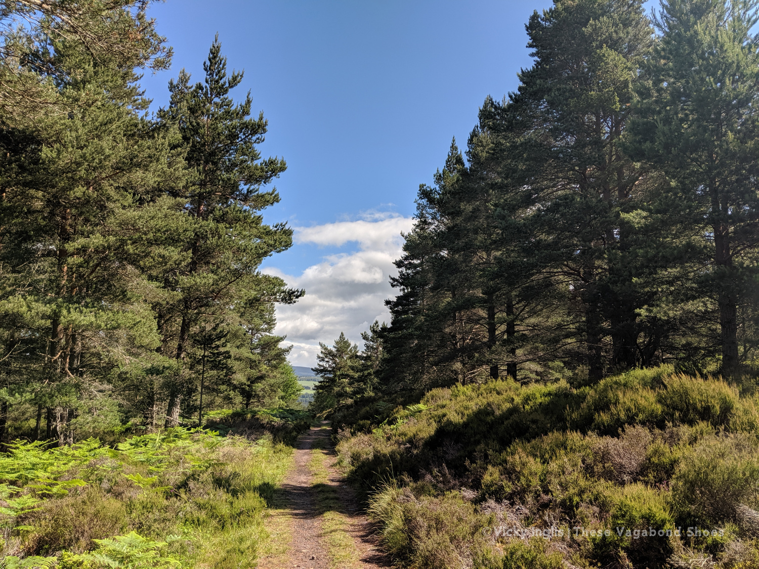
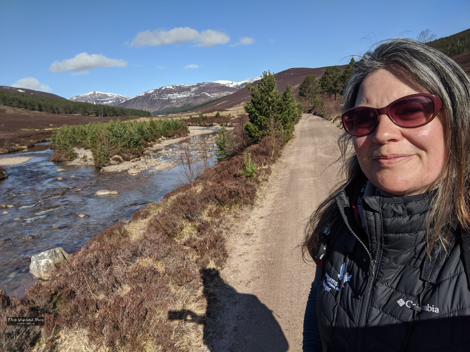
The River Dee is one of the most impressive rivers in Scotland, rising high on the Cairngorm Plateau, before squeezing through the narrow cataract of Linn of Dee and carving a course for the coast through rolling hills backing on to high mountains, impressive pinewoods, colourful birch forest, and heather-clad moor.
This area of Aberdeenshire has attracted travellers long before association with Queen Victoria and Balmoral Castle earned it the epithet Royal Deeside, and a position firmly on the tourist trail to the Highlands. The corridor of the River Dee was a easy route between east and west, into the heart of the Cairngorms from the coast, and a safe refuge for drovers, riders, and raiders passing through the mountain passes and wilder lands to the north and south, around the majestic peak of Lochnagar.
The towns of Aboyne and Ballater, and the village of Braemar (one of the highest villages anywhere in the UK), Dinnet, and Crathie are the main settlements in the area, and any could be the ideal base for taking these walks. Braemar is only around one and a half hours drive from Aberdeen, so these walks are all easily possible as part of a day trip out from the city.
These are 10 of my favourite walks on and around Royal Deeside, Aberdeenshire, in the eastern part of the Cairngorms National Park; opportunites to slow down your travel through the area and explore deeper into this stunning part of Scotland.
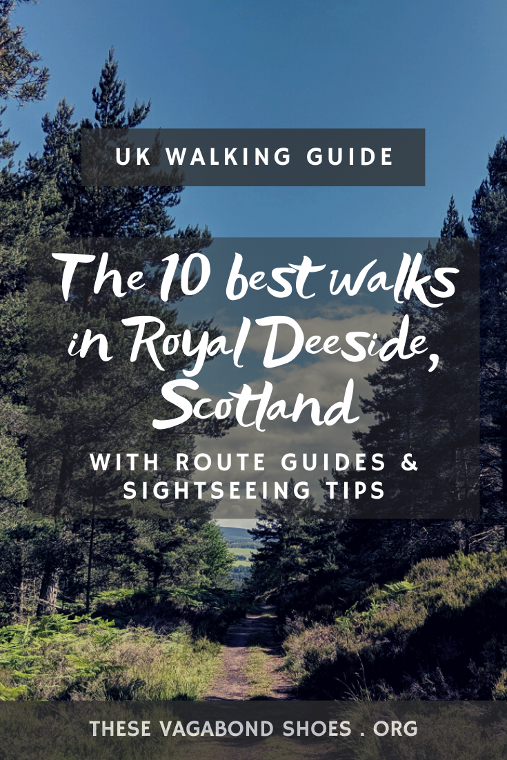
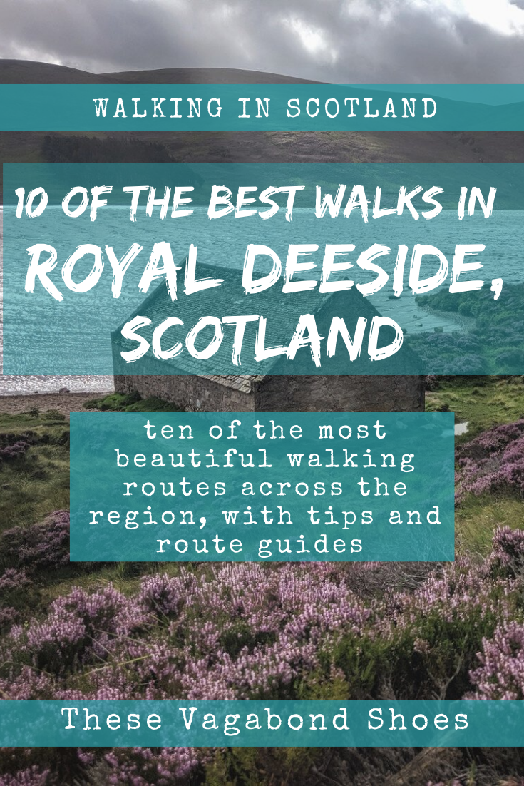
The 10 Best Walks in Royal Deeside, Aberdeenshire
Parkin’s Moss Trail, Muir of Dinnet National Nature Reserve
- Start: Burn o’Vat Visitor Centre
- Distance: 3.2km (2 miles)
- Time: approx. 1.5 hours
- Difficulty: easy

There’s several possible options for walks at Muir of Dinnet National Nature Reserve, including the otherworldly granite cauldron of Burn o’ Vat, but the waymarked route taking in Parkin’s Moss is my favourite. A boardwalk snakes over the raised bog, keeping your feet dry while offering a rare glimpse into an unusual and highly threatened habitat which buzzes with wildlife and unusual plant species. Look out for lizards sunning themselves on the wooden track, and watch the aerial agility of dragonflies and damselflies. Get close to several species of lichens, misses, and fungi. The route is well waymarked, and details of the walk can be found on leaflets and information panels at the Burn o’Vat Visitor Centre.
Creag Chòinneach, Braemar
- Start: Braemar
- Distance: 3.2km (2 miles)
- Time: approx. 1.5 hours
- Difficulty: easy / moderate

At just 538 metres (1,765′) high, the beautiful small hill of Creag Chòinnich is rather dinky in mountain terms, but the short and steep ascent to the top make it feel much grander in stature, and it throws in a false summit just for good measure. After a few hundred metres of ascending through the pine woods, home to red squirrels, numerous woodland birds, and elusive pine martens, the trail emerges through the trees to a rocky approach to the peak, with views down over the village of Braemar. On finding the summit cairn, you’ll be treated to panoramic views over Strathdee, including Braemar Castle and Invercauld House on the side of the river, to the mountains of Morrone and Càrn na Drochaide, and Beinn a’ Bhuird and Ben Avon in the far distance. Return by the same route. Parking is available in the village centre, or at the Highland Games ground. Find the route here.
Burn o’Vat and Culblean Circuit, Muir of Dinnet National Nature Reserve
- Start: Burn o’Vat Visitor Centre
- Distance: 6.5 km (4 miles)
- Time: approx. 2 hours
- Difficulty: easy
Another wonderful route at Muir of Dinnet National Nature Reserve, this time taking in Burn o’ Vat, an immense pothole formed by the melting of the ice sheet covering the area at the end of the last Ice Age. Get access by squeezing through a narrow gap, though you may risk wet feet, and it is occasionally impassible if the burn is high. Continue on through the pine and birch woods into more open ground to cross the shoulder of Culblean Hill, and descend to Loch Davan, a kettle lake, like neighbouring Loch Kinnord, that’s a beautiful wildlife refuge at the northern end of the nature reserve. The route back to the start continues the story of glaciation, following the winding ridge of an esker. Find the route here.
Note: Burn o’Vat car park can become full on a busy summer weekend, so it is advisable to arrive early (or later in the day, making use of long summer evenings), or to use alternative parking available at Cambus o’May Forest Trails to access the circuit from a different point.
Morrone Birkwood, Braemar
- Start: Braemar
- Distance: 4.5 km (2.75 miles)
- Time: approx. 1.5 hours
- Difficulty: easy / moderate

Morrone Birkwood takes its name from the downy birch trees (birk is Birch in Scots) that clad the flanks of Morrone, the Corbett* that overlooks the village of Braemar. The waymarked circular walk passes through the birch and juniper woodland, which is a relic of what landscapes would have looked in the years following the retreat of the ice sheets at the end of the last Ice Age, into more open heather moorland. I think this is route is at it’s most stunning in autumn, when the trees and bracken turn golden and bronze, the path is lined with incredible fungi, and the air filled with the bellowing of red deer stags. Parking is available at the Braemar duckpond on Chapel Hill, or at the Highland Games ground. Find the route here.
Hikers looking to push themselves a bit further and longer could complete a longer circuit that takes in an ascent of Morrone (12km / 7.5 miles, with 650 metres / 2,132′ of ascent). It’s a nice peak to build up to attempting some of the Munros in the area, and the sweeping views across Upper Deeside to the mountain plateaux of the Cairngorms are stunning.
*A Corbett is a Scottish mountain between 762 and 914 metres (2,500 and 3,000′) high, with a topographical prominence of 152 metres (500′).
Read: A Beginner’s Guide to the Munros
Old Pines Trail, Glen Tanar
- Start: Glen Tanar Visitor Centre
- Distance: 8 km (5 miles)
- Time: approx. 2.5 hours
- Difficulty: easy/moderate

Glen Tanar is easily one of the most beautiful parts of the Cairngorms National Park, holding the largest remnant of the Caledonian pinewoods east of the Cairngorms along the banks of the Allochy Water and Water of Tanar. The woods are home to wildlife like red squirrels, pine martens, and Scottish crossbills, as well as rarer species like capercaillie and the elusive Scottish wildcat. The waymarked trail uses parts of the old Firmounth Road, one of several ancient routes that cross the mountains, known as the Mounth, between Deeside and the Angus Glens, used historically by the cattle drovers, itinerant farm labourers, and travelling folk on the move between Highlands and Lowlands, and in more recent times by hikers and mountain bikers. Find the route here.
The Queens Drive and the Lion’s Face, Braemar
- Start: Braemar
- Distance: 9.5 km (6 miles)
- Time: approx. 3 hours
- Difficulty: moderate

A beautiful waymarked circular walk starting and finishing in the centre of Braemar. The route follows the River Clunie upstream before picking up the Queen’s Drive, named of course for Queen Victoria, and one of her favourite routes for scenic carriage drives. The trail gently gains height to give stunning views over Braemar and Glen Clunie, and further on of stately Invercauld House and the River Dee. Beyond, you can glimpse the distinctive granite tors on the plateau of Ben Avon on a fine day. The path winds under a rocky crag known as the Lion’s Face, though I’m yet to pick out the resemblance. The route passes close to Braemar Castle, worth visiting if you have the time. This walking route is formed by combining the Queen’s Drive route found here (4.5km / 2.75 miles) with the Lion’s Face and Cromlins route found here (5.5km / 3.5 miles), so can also be completed as two shorter walks using the steep route through Corrie Feragie.
Seven Bridges Walk, Ballater
- Start: Ballater
- Distance: 10.5 km (6.5 miles)
- Time: approx. 3 hours
- Difficulty: moderate
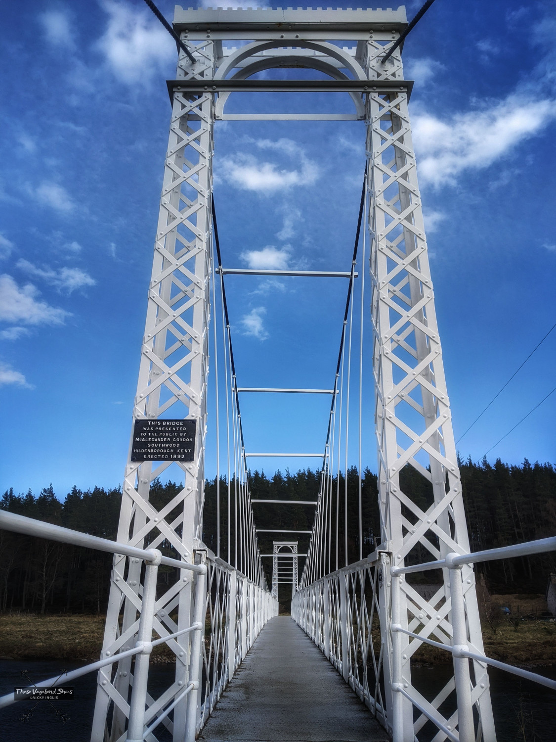
This is my most regular haunt along Deeside, and I love returning the route at different times of the year to spot the small changes that occur and observe the turn of the season. The waymarked route starts and finished in the picturesque town of Ballater, with its longstanding royal connections stemming from Queen Victoria’s love of the surrounding area, and the summer homes of her descendants not far from town, and traces the route of the river Dee.
Some of the bridges are recorded in the names of the places you pass through, Bridge of Gairn and Bridge of Muick, others are much harder to spot. There’s no missing the grand pink granite Royal Bridge on the edge of Ballater and the beautiful white-painted cast iron suspension bridge at Polhollick, at the point where the walk turns for home. A diversion to Knock Castle, a ruined 16th century towerhouse with an interesting history, adds around 2.5km to the walk. Find the route here.
Read: The Seven Bridges Walk in Ballater, Aberdeenshire
Balmoral Cairns Walk, Crathie
- Start: Crathie
- Distance: 9.5 km (6 miles)
- Time: approx. 3 hours
- Difficulty: moderate

This route is beloved of Instagrammers and bloggers, who talk of Prince Albert’s cairn as the “Secret Pyramid” (which is so secret you can spot it from the bus stop on the main road), so it can be busier than many others on the list through the peak of summer. But there are several more cairns dedicated to events in the lives of Queen Victoria and Prince Albert, and to their many children scattered across the hillside to explore, and a number of stunning views across Balmoral Estate to discover, so once in the woodland you’ll find spots of peace and quiet. The cairns route is not waymarked, and there are many trails criss-crossing through the woods, so a map is advised.
The majority of the cairns lie on land that is exempt from the access legislation that covers most of Scotland, so when the royal family are in residence at Balmoral it is not possible for members of the public to visit them (usually for around six weeks in August and September). It is still possible to visit Prince Albert’s cairn at that time. Find the route here.
Loch Muick Circuit, Glen Muick
- Start: Spittal of Glenmuick
- Distance: 12.5 km (7.75 miles)
- Time: approx. 3.5 hours
- Difficulty: moderate
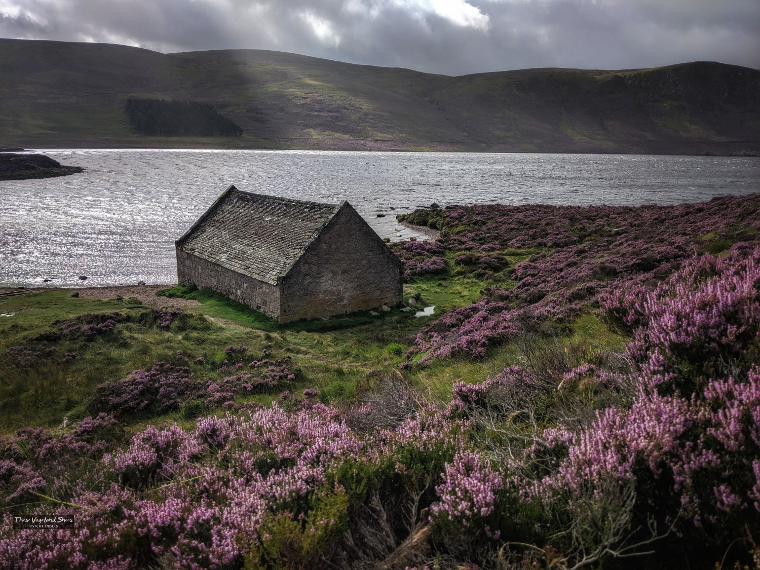
This route is a fairly level circuit of Loch Muick, through rough in places around the head of the loch. The views of the loch and surrounding mountains are superb, and in autumn there’s always a chance of spotting a stag or two. You’ll also pass by the granite lodge house of Glas-Allt Shiel, built for Queen Victoria as a quiet retreat from Balmoral following the death of Prince Albert.
The Glas Allt waterfall is a worthwhile detour on the route, especially after recent rains. The steep track, which can be challenging in places, will add around an hour to times for completing a circuit of the loch. The return to Spittal of Glenmuick on the eastern side of the loch joins the Capel Mounth, another of the old roads that crosses the Mounth between Deeside and the Angus Glens, and a fine walking route into Glen Clova for another day. Find the route here.
Note: Spittal of Glenmuick car park can become full on a busy summer weekend, leading to the closure of the glen road, so it is advisable to arrive early (or even later in the day to make use of the long summer evenings).
Clais Fearnaig Circuit, Mar Lodge National Nature Reserve
- Start: Linn of Quoich
- Distance: 16.5 km (10 miles)
- Time: approx. 4.5 hours
- Difficulty: moderate / hard
This is a beautiful walk through the regenerating pinewoods of the Mar Lodge estate, where efforts to manage deer numbers for conservation by National Trust for Scotland is now showing remarkable results in this rare and special environment. The route begin by heading up Glen Quoich, and it’s worth the short diversion to see the Linn of Quoich and the Punch Bowl. Legend has it the leaders of the forces assembled by the Earl of Mar drank a toast from it, before riding to Braemar to raise the standard at the start of the 1715 Jacobite rebellion.
After traversing the Clais Fearnaig pass, the route passes through Glen Lui into the pine woods of Doire Bhraghad, before descending past the Victorian hunting lodge buildings of Mar Lodge and following a meander of the river. There is a short section of walking on a single-track road to return to the start. Find the route here.
Read: What to pack for day hikes in the UK
The Scottish Outdoor Access Code
In Scotland, we have a right of responsible access to most land, which allows us to enjoy activities in many areas like hills, moorland, and mountain, forests, beaches and coasts, parks, and some farmland, so long as we do so respectfully. This means there’s a huge area available to go walking around Deeside and the Cairngorms, not just the suggestions on this list. To ensure the protection of habitats and wildlife, you should be familiar with the Scottish Outdoor Access Code, leave no trace of your visit, and any advice from land owners, land managers, and conservation organisations on signs.
Have you tried any of these walks for yourself? Let me know how you got on in the comments below. Do you have any favourite walks on Deeside?
Inspired by what you’ve read? Why not pin this post?