
The most outstanding long-distance tramping routes you’ll find in New Zealand.
I love hiking when I travel. It’s an affordable way to see some of the most magnificent places in a country, and a great way to meet like-minded people when you’re travelling solo. In New Zealand, multi-day hiking is referred to as tramping, and is popular with both Kiwis and visitors from further afield.
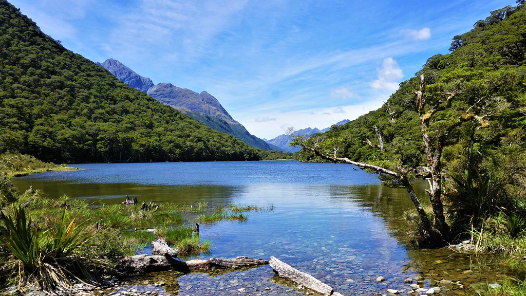
From seemingly endless beaches and surf-crashed coastlines, through rolling farmland and forested ranges of hills, to lunar volcanic landscapes, soaring peaks and high mountain passes, the country is spectacularly diverse for such a small area. New Zealand has thousands of kilometres of tramping trails, including ten that are known as the Great Walks and journey through some of the most iconic Kiwi landscapes.
Tramping allows you to get outdoors and explore the country in a way that no other travel experience can match. Not only that, but you’ll also be treated to incredible nature encounters, the freshest air, and the freedom that comes with being wild and remote. But which route should you choose? I’ve compiled a list of what I think are some of the most outstanding hiking trails in New Zealand, some I’ve walked for myself, and others which remain firmly on my to-do list for when I next return.

The routes vary greatly in character, from waymarked hut-to-hut trails like the ever-popular Queen Charlotte Track and Tongariro Northern Circuit to epic challenges aimed at experienced backpackers with plenty of time on their hands, like the Te Araroa Trail.
These routes all take multiple days to complete, and due to the remote nature of the country they cross, there’s usually little opportunity to break them down into single days or weekends trips. Once you start a route, you’re often committed to seeing it through. However, most of the routes have excellent facilities, and there’s plenty of advice and information available from the Department of Conservation (DOC) to help you prepare.
If you aren’t quite ready for the challenge of a multi-day walk, or just fancy a taster of what New Zealand tramping is all about, have a look at my list of the best day hikes for inspiration.
Here are, in my opinion, the best long-distance tramping routes you’ll find in New Zealand.
Tongariro Northern Circuit
- Start and Finish: Whakapapa Village
- Length: 45km
- Average time to complete: 4 days
- Difficulty: easy to moderate
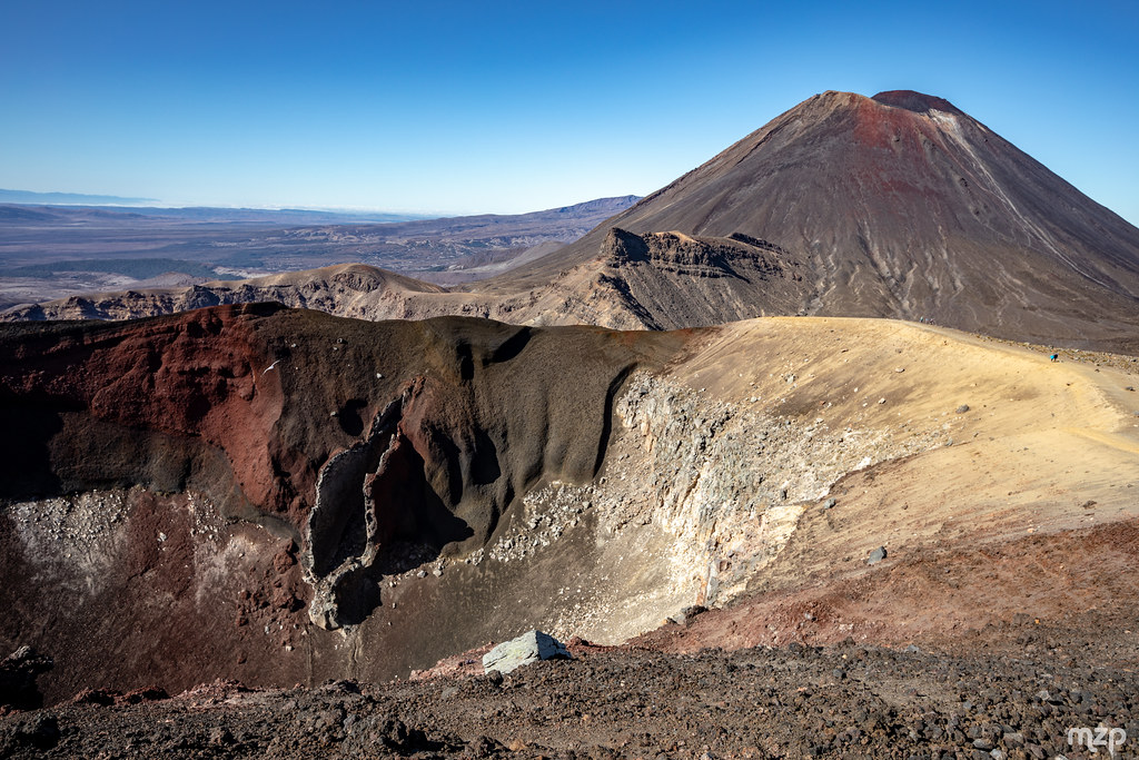
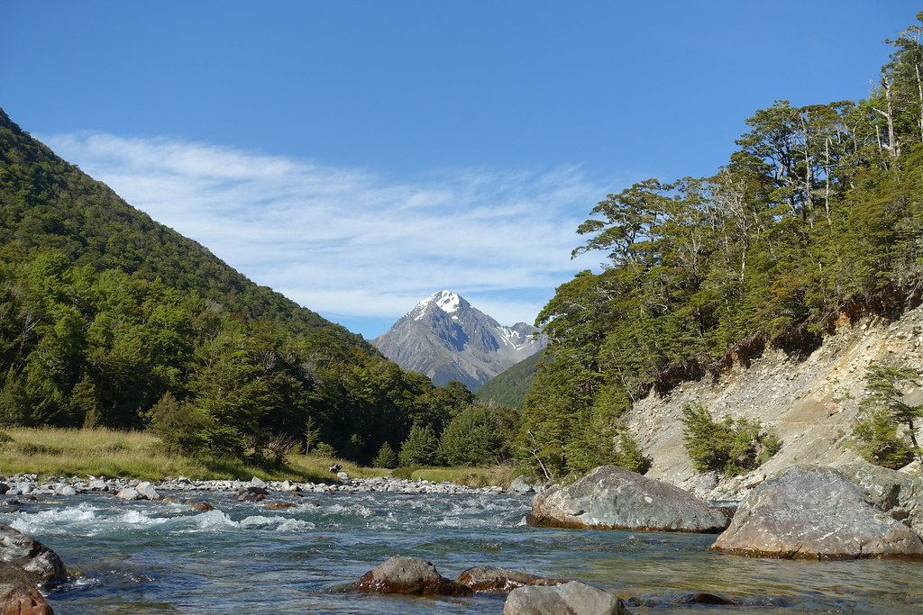
In some of the most dramatic scenery in New Zealand, the Tongariro Northern Circuit is the big brother to the Alpine Crossing, one of New Zealand’s most spectacular day hikes. The tramping route extends your time in the area for an additional few days, letting you explore a landscape of wonders, from emerald-green lakes and steaming craters, sculptural silica terraces and old lava flows, and distinctive alpine gardens.
The mountains of the Ruahepu region are considered sacred to the local Ngāti Tuwharetoa iwi, who gifted the area to the nation of Aotearoa / New Zealand, allowing the creation of Tongariro National Park in 1887, the first in the country and only fourth in the world. The region is inscribed on the UNESCO List of World Heritage Sites with dual recognition for its outstanding natural and intangible cultural values.
The circuit can be accessed from several points and walked in either direction, though most hikers choose to start in Whakapapa and reach Mangatepopo hut on the first day, to complete the Tongariro Alpine Crossing as their second day. A sidetrack to the summit crater of Mount Ngauruhoe, immediately recognisable as Mount Doom, has had trail markings removed, and the local Ngāti Hikairo Ki Tongariro iwi ask that the mountain is not climbed.
Lake Waikaremoana Great Walk
- Start: Onepoto Shelter, around 64km from Wairoa
- Finish: Hopuruahine Landing, around 150km from Rotorua
- Length: 46km
- Average time to complete: 4 days
- Difficulty: moderate
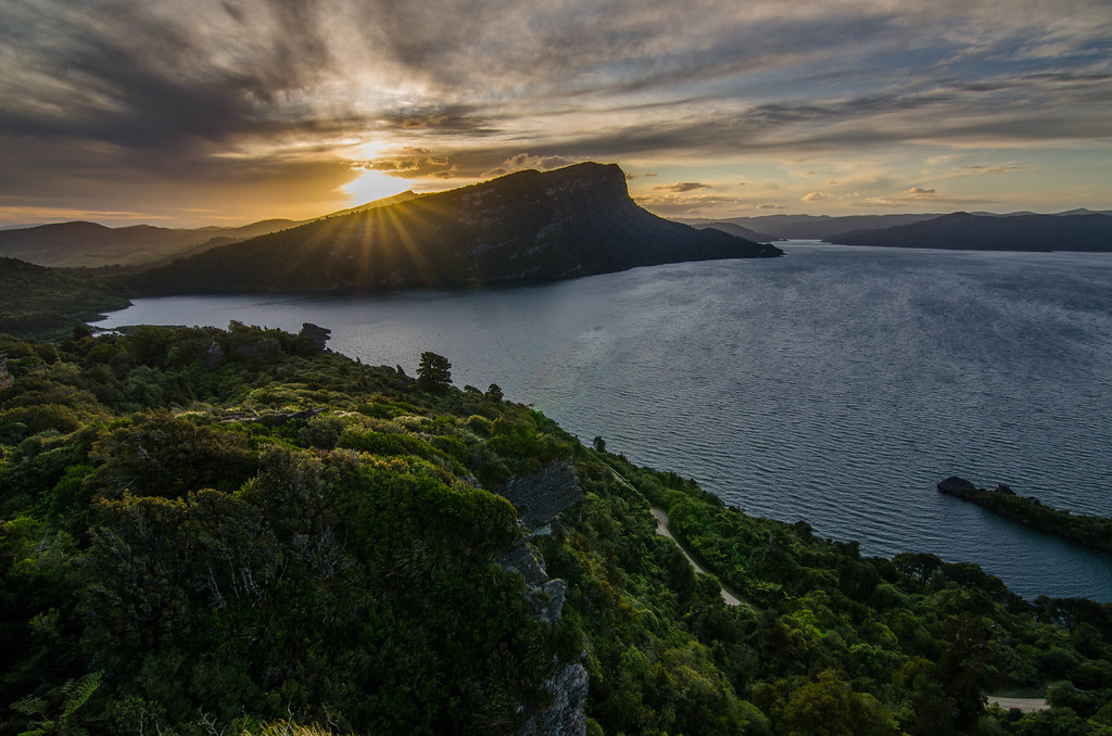
Lake Waikaremoana, and the surrounding valleys and mountains, lie at the heart of Te Urewera, a truly outstanding place. The historic homeland of the Ngāi Tūhoe Māori, the “Children of the Mist”, Te Urewera is the first natural feature to be recognised in New Zealand law as a legal entity in its own right, a landmark recognition of indigenous peoples relationship with the land.
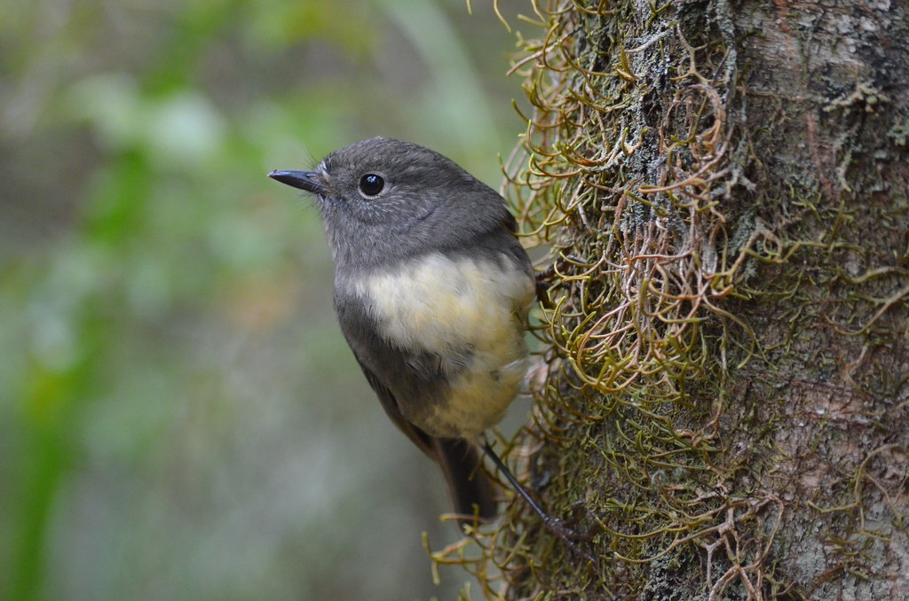
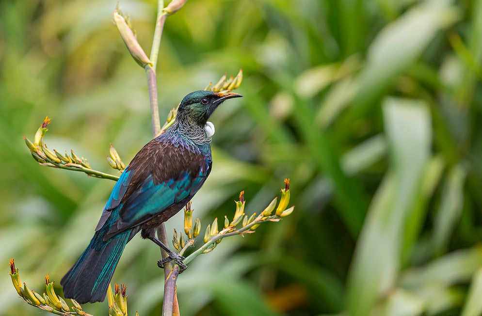
Like a throwback to a prehistoric time, Te Urewera is the largest area of native forest in the North Island, crossed with misty valleys and magical waterfalls, and home to some of New Zealand’s most iconic birds. Listen out for the calls of tui and kereru, and as darkness falls, the kiwi.
The horseshoe-shaped tramping route can be walked in either direction, though most hikers start from Onepoto Bay to tackle the climb up Panekire Bluff and pass the highest point of the route at Puketupu Trig (1180m / 3871′) on the first day. For the rest of the route, you’ll be alongside the lake and have the chance to take a dip in crystal-clear water at the end of each day.
Queen Charlotte Track
- Start: Meretoto / Ship Cove
- Finish: Anakiwa
- Length: 72km one way
- Average time to complete: 4 days
- Difficulty: easy
The first multi-day tramping trail I did in New Zealand, the Queen Charlotte Track is the perfect introduction for first-timers and solo hikers. Passing through lush forests, filled with the sound of native bird species, the track follows shorelines and crosses ridgeline passes with spectacular views of the Queen Charlotte Sound and Kenepuru Sound.
The network of coves and bays around the Marlborough Sounds are said to come from the intricate carvings on the prow of Maui’s waka (canoe), which capsized to become the South Island as he fished up the giant stingray that became the North Island of New Zealand.
Most hikers start at Meretoto / Ship Cove, taking a water taxi out, finishing at Anakiwa. Sections of the track cross private land, and it’s necessary to buy a pass before starting to walk. The terrain is fairly easy-going, and you have the option to alternate camping or hut accommodation with luxury lodges on the route. A water taxi can transport your pack between overnight stops, and even gives the option for a rest day cruise.
The water taxi service also means sections of this track can be completed as day walks.
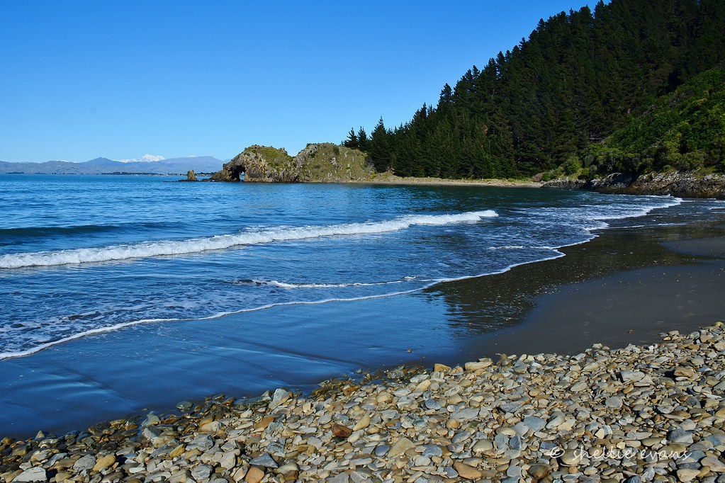
Heaphy Track
- Start: Brown Hut, around 28km from Collingwood
- Finish: Kōhaihai River, around 15km from Karamea
- Length: 79km one way
- Average time to complete: 5 days
- Difficulty: moderate
The Heaphy Track is probably the Great Walk with the greatest diversity of landscapes and scenery on its route, as it passes through the Kahurangi National Park. The route begins in lush subtropical rainforest, reaching tussock grasslands fringing rugged mountains at its highest point, before dropping down to lowland forest and palm-lined surf beaches.
The route takes its name from Charles Heaphy, a surveyor in the New Zealand Company who traversed part of the route in 1846 but had long been used by the Māori of Golden Bay to prospect for pounamu/greenstone in the Westland rivers. The area around the Heaphy Hut is home to one of the oldest archaeological sites in New Zealand.
The trail is well waymarked, and there are bridges on all major river and stream crossings. The track reaches the highest point, Flannagan’s Corner (915m /3,002′), towards the end of the first day. The track can be walked year-round, but always be aware of the weather forecast. The west coast of South Island has extremely high annual rainfall, and heavy rains can cause local flooding around rivers with little notice.
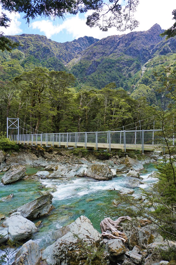
Travers-Sabine Circuit
- Start and Finish: St Arnaud
- Length: 85km
- Average time to complete: 6 days
- Difficulty: hard
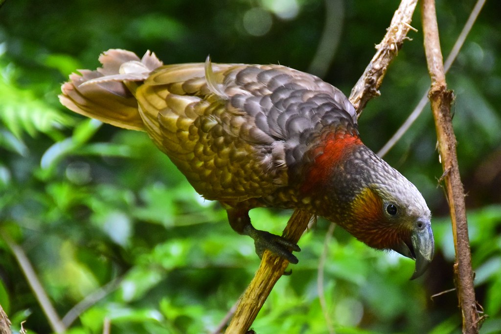
The Travers-Sabine Circuit at the heart of the Nelson Lakes National Park takes hikers from peaceful lakeside beech forests carpeted in mosses and ferns, to tussocky alpine meadows to boulder fields of fractured rock, and a typical glaciated landscape of steep ridges and scree slopes. Look out for native birds, including keas on high ground (and make sure your camp is well secured).
The tracks are waymarked and most streams are bridged, though some sections are steep and cross rough, exposed ground. The route crosses the Poukirikiri/Travers Saddle at (1,787m / 5,863′), where snow cover sometimes persists as late as November, and may require crampons and an ice axe. It’s recommended to complete the circuit in a clockwise direction for an easier crossing of the alpine pass.
A diversion to the Angelus Hut (1,650m / 5,413′) opens up additional tramping routes on Mount Cedric and Roberts Ridge, though booking a space in the hut is essential at certain times of the year. Backcountry Hut Passes or Backcountry Hut Tickets are required to stay in all the huts on route, though the route itself does not require a permit.
Routeburn Track
- Start: Routeburn Shelter, around 25km from Glenorchy
- Finish: The Divide Shelter, around 85 km from Te Anau
- Length: approximately 33km one way
- Average time to complete: 2 days (or 4 as an out-and-back tramp)
- Great Walks season: End of October to end of April
- Difficulty: moderate to hard
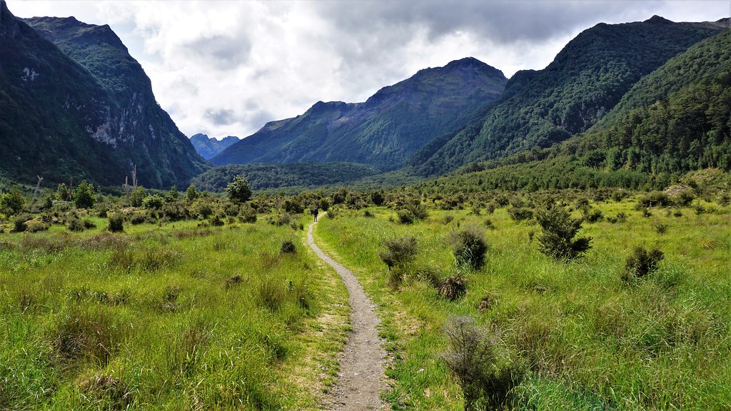
In the southwest of South Island, the Routeburn Track links Mount Aspiring and Fiordland National Parks through alpine meadows and ice-carved valleys, past tumbling waterfalls and sparkling lakes, rewarding trampers with breathtaking views of the mountain peaks and passes of the Southern Alps, also known as Kā Tiritiri o te Moana.
One of the New Zealand Great Walks, the route can be hiked in either direction, though the majority of walkers will make a 4-day return trip from the Routeburn Shelter with Queenstown as a base for their travels. Space in campsites or backcountry huts on the route must be booked in advance, which manages the number of walkers on the track.
The track is well waymarked, though some sections are steep and cross rough ground. The highest point of the route is Harris Saddle / Tarahaka Whakatipu at 1,255 metres (4,117′) high, though a steep sidetrack can be taken to the summit of Conical Hill (1,515m / 1690′).
Notoriously fickle South Island weather can make this a challenging route at any time of year, and the DOC strongly recommend the route isn’t attempted outwith the Great Walks season. A quick internet search on the Routeburn Track will reveal dramatic stories of accidents, survival, and extreme weather events leading to damage on the trail.
Rakiura Track
- Start and Finish: Oban, Rakiura / Stewart Island
- Length: 35km
- Average time to complete: 3 days
- Difficulty: easy to moderate
Way down at the bottom of the country is Rakiura / Stewart Island. With around 85% of the island protected as a National Park and less than 400 permanent residents, the island has a rugged coastline, lush native bush, and a slower pace of life.
The circular route can be hiked in either direction, though most trampers usually start from the road end in Lee Bay and take an anticlockwise direction. If you’re starting walking from Oban, this adds just an additional two hours to the total time. The route is well waymarked and not considered too challenging, though it has a notorious reputation for mud, as a result of the peat soils and high rainfall typical in the region.
Despite the most southerly location of any route on this list, the Rakiura Track is open year-round. Rakiura, the Māori name for Stewart Island, means land of the glowing skies. The island was designated as an International Dark Sky Sanctuary in 2019, so a winter tramping trip will almost guarantee long, star-filled nights, and may even give you a tantalising green glow from the aurora australis (southern lights).
Te Araroa Trail
- Start: Cape Reinga, North Island
- Finish: Bluff, South Island
- Length: approximately 3,000km (1,900 miles)
- Average time to complete: anywhere between 3 and 6 months
- Difficulty: epic!
Te Araroa, meaning The Long Path, spans the entire length of the two largest islands of New Zealand, connecting the northernmost tip of North Island to the southernmost point of South Island. The trail was officially opened in 2011, integrating some existing trails like the Queen Charlotte Track and the Tongariro Alpine Crossing, though the development of the route is still ongoing and upgrades are being made each year.
I don’t do a bucket list, but completing this trail is a big dream of mine. The route crosses some spectacular wilderness areas, and also connects major towns, smaller rural settlements, Māori marae, and backcountry huts on the way, giving an incredible in-depth experience of New Zealand, and the people that make the country such a special place.
The North Island section is just over 1,600km, and the South Island section just under 1,400km. Covering an average distance of 25km a day, the trail would take 120 days or 4 months to complete. Most trampers attempting the Te Araroa trail start at Cape Reinga in late spring (late October to early November), heading southwards, to traverse the South Island in late summer (late January to February), when mountain passes are usually snow-free and rivers are low.
Planning a long-distance hike tramp in New Zealand
In New Zealand, you don’t do a long-distance or multi-day hike, you go tramping.
The local Department of Conservation (DOC) office should be your first port of call before heading out on a tramp. Here you can buy trail maps, ask lots of questions, find out more background on the history and nature of the track, leave a note of your intentions, and staff can give you the most up-to-date information on trail conditions and weather forecasts.
The Adventure Smart website is an excellent resource to ensure you prepare thoroughly and stay safe when you head out to the bush. And the Mountain Safety Council provide a handy online planning tool that makes sure you cover all bases before you hit the ground.
New Zealand has an outstanding network of backcountry huts maintained by DOC, many of which are serviced all or at least part of the year, and other organisations such as the New Zealand Alpine Club. Most operate on a first-come basis, however, huts on the more popular Great Walks may need to be booked in advance.
The DOC huts on the trails I’ve listed above provide bunks to sleep in, toilet facilities (usually long-drop or composting loos), and a water supply, and some may also have heating and cooking facilities with fuel. Backcountry huts don’t have food supplies, cooking equipment, or rubbish bins. All waste brought into a hut should be packed out again, including food waste which can encourage pests.
Wild Camping
You might choose to camp rather than stay in huts, and wild camping (also known as freedom camping) is permitted on public land in New Zealand, with some exceptions. However, to manage pressure on popular trails, particularly through sensitive habitats, the DOC also provide free or low-cost campsites with basic facilities (often just a water supply and long drop or composting toilets), which should be used.
You must be familiar with the Camping Care Code promoted by the DOC and follow leave no trace principles. Local DOC offices and i-Sites can give you more information, and you can share a Tiaki Promise as a commitment to caring for the places and people of New Zealand.
Water Supply
Ask the DOC staff about the safety of drinking water on the trail, as in some areas the waterborne parasite Giardia may be present. On higher ground the water from mountain streams is usually safe, however, if you are unsure about the quality it’s always a good idea to boil water for three minutes before drinking.
Weather
Be aware of the weather. New Zealand weather is very changeable. Even if it’s summer or the forecast is good, you should always carry a rain jacket and warm clothing. Check MetService for the most up-to-date forecast.
Be sure you’re adequately prepared; check long-range forecasts and monitor the weather during your hike, pack sufficient warm layers and waterproof jacket and trousers, and know your route well enough to identify wet weather alternatives and bail-out points if conditions become too bad.
Wildlife
New Zealand doesn’t have the large (or deadly) wildlife of North America or Australia to worry about, and you should try to avoid causing any disturbance to habitats or creatures you may encounter. In some areas, there may be active conservation to control pests and predators, including trapping and the use of 1080. Find out more here.
New Zealand sandflies have a well-deserved reputation, as fearsome as the notorious Scottish midges, and just as prone to congregating in the most beautiful locations in the country. October and April are usually the best months for avoiding the wee beasties but still getting the best of the weather. Otherwise pack a repellent, especially for dawn and dusk, and just after rain showers.
In some upland parts of the South Island, you may be fortunate to encounter keas, beautiful, but highly endangered Alpine parrots, with no fear of humans and an enormous sense of curiosity. They will attempt to open packs, bin bags, and tents left unguarded, so be sure to keep a tidy and secure camp. Don’t feed them, as this teaches them to associate human activity with an easy food source, and passes on the problem to future trampers and campers.
What if…?
Huts on the trails have an intentions book to fill out details of your trek, including the times and locations you expect to arrive, which can be a valuable source of information for the Police, Land Search and Rescue (Land SAR), and DOC Rangers in an emergency. The intentions book should also be filled out if you’re camping on the route.
Mobile phone coverage is poor or non-existent in large areas of the country, which also means GPS and digital mapping may not be reliable. The local DOC office often has personal locator beacons that you can hire, which are vital if you’re tramping solo or on the trails outside of the peak season. If you do have an emergency, activating the locator beacon will assist Land SAR in being able to find you. The chances are you’ll never need to use it, but it can provide immense reassurance to take one with you.
Winter
Winter tramping in New Zealand is a serious business, particularly on South Island, and brings several additional hazards to the trails. Some of the tracks listed above will be closed for the duration of the winter season and others will be impassable to all but the most experienced hikers.
To attempt a track in winter conditions, you will need to be experienced in backcountry navigation and have river crossing expertise. Huts on a route may be closed, or facilities are greatly reduced, with no wardens present or emergency hut radios left out.
It is important to be properly prepared for winter tramping, which could mean taking additional equipment, like an ice-axe and crampons, and having the training to use them correctly. It also means taking additional time in the planning stages: to assess underfoot conditions of your chosen route, following mountain weather and avalanche forecasts, and accounting for reduced daylight hours.
Some of the tracks crossing high ground can experience winter conditions at any time of the year, and may actually be riskier through spring when increasing temperatures, high rainfall, and snowmelt can trigger avalanches or flash flooding.
It also means that sometimes the best choice you can make is to postpone the hike for another time, or turn back rather than push on.
So what do you think? Do any of these trails take your fancy?
Have you done any of these incredible tramping tracks? Do you have any tips for top tramping in New Zealand?
Let me know what you think in the comments below.
Inspired by what you’ve read? Why not pin it for later?

2 thoughts on “8 of New Zealand’s Greatest Long Distance Tramping Routes”