
A selection of some of the best one day tramping tracks in New Zealand, plus a couple of options for overnight hikes.
Few places in the world can top New Zealand for stunning, dramatic scenery. A little bit of everything, from rolling hills and lush forests, to majestic rivers, raw volcanic landscapes, sweeping coastlines and soaring mountains tempt hikers from around the world to pull on their boots and explore the great Kiwi outdoors.
Known as tramping by New Zealanders, hiking is the best way to explore the country in a way no other experience can really match, and available whatever your travel budget. Routes are generally well waymarked, the quality of mapping is excellent, and people are welcoming and glad to provide advice. And the best part is that wild land is easily accessible in New Zealand, and it’s possible to feel a sense of remoteness just a couple hours from cities and towns.
Whichever routes you chose, you’ll be treated to fresh air life outdoors, spectacular views, and that feeling of freedom that comes with hiking in wild places. My experience of hiking in New Zealand is you never quite know exactly what to expect, or where the trail might eventually lead you.
It’s a dangerous business, Frodo, going out your door. You step onto the road, and if you don’t keep your feet, there’s no knowing where you might be swept off to.
The Fellowship of the Ring, J.R.R. Tolkien
But which tramping trails are right for you? I’ve compiled a list of what I think are some of the best short hiking trails in New Zealand, for whichever part of the country you’re visiting. Or add them to your plans for an epic New Zealand road trip. Some I’ve walked for myself, and others I’ve added to the list for when I return next. My suggestions for multi-day tramping routes can be found here.
So, here are 11 of my favourite one-day and overnight hikes in New Zealand.
Te Whara Track
- Base: Whangārei
- Route length: 7.5km one way
- Approximate hiking time: 5 hours
- Difficulty: moderate
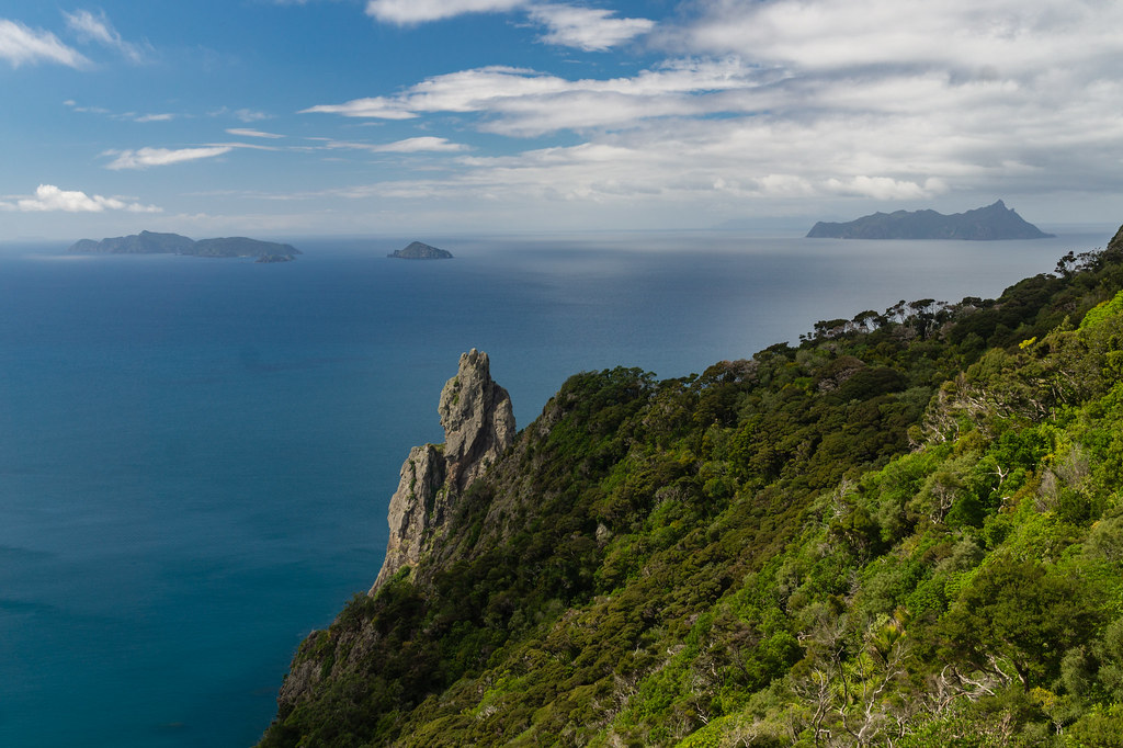
The Te Whara Track traces the route of an ancient Māori trail between Ocean Beach and Urquharts Bay near Whangārei Heads, through some stunning coastal forest. Soon after leaving Ocean Beach the route ascends sharply to the summit of Bream Head, and a spectacular panoramic vista unfolds.
On a clear day, you can see the coast from Cape Brett / Motukokako in the north to Cape Rodney / Tawharanui in the south, as well as Tawhiti Rahi and Aorangi in the Poor Knights Islands, Taranga and Marotere Islands in the Hen and Chicken Islands, and as far as Great Barrier / Aotea Island and Little Barrier/ Te Hauturu-o-Toi Island in the Hauraki Gulf.
Beyond the ridge, the track is undulating and relatively easy-going to Urquharts Bay. The local iwi request that hikers stick to the waymarked tracks to minimise disturbance in the area.
Tongariro Alpine Crossing
- Base: Whakapapa or National Park
- Route length: 19.5km one way
- Approximate hiking time: 7 hours
- Difficulty: challenging
The Tongariro Alpine Crossing has the reputation as one of the greatest day hikes, not just in New Zealand, but anywhere in the world. The huge popularity of the route means it can get busy on the trail, but also that there’s a great support infrastructure for hikers keen to undertake the challenge. Read about my hike here.
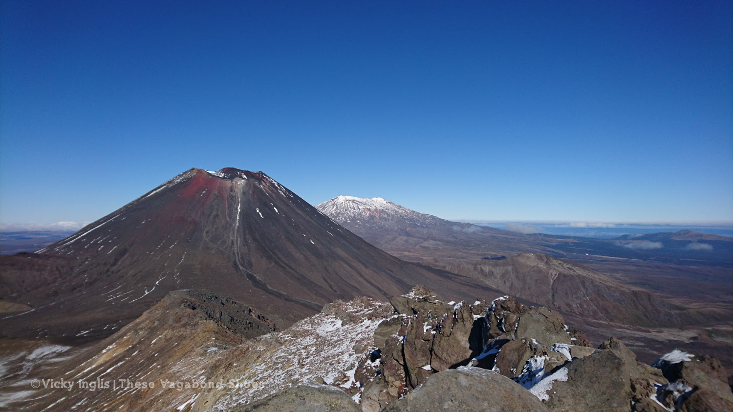
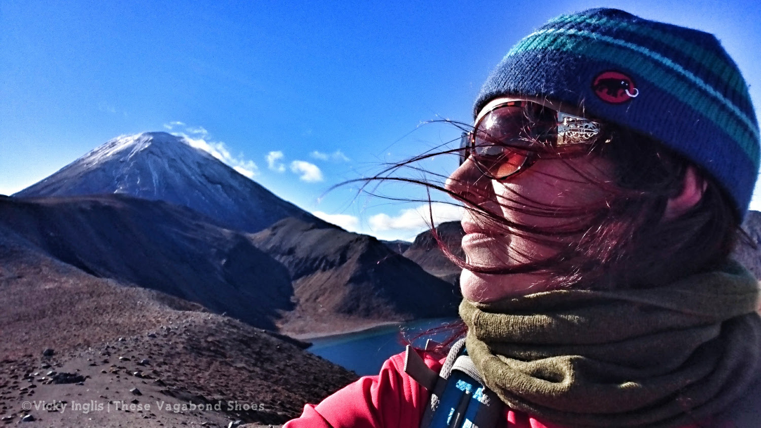
The route takes hikers into the fiery heart of a volcanic caldera, leaving behind alpine vegetation and glaciated valleys, to enter an otherworldly landscape of steaming vents, jewel-coloured crater lakes, and ancient lava flows.
Starting at Mangatepopo car park, hikers are already at an altitude of 1,100m, with the trail reaching a maximum height of 1,886m crossing the Red Crater, before descending a volcanic scree slope to the stunning Emerald Lakes / Nga Rotopounau (the greenstone-hued lakes).
Take care while hiking, as the scree can be unstable underfoot and some sections of the trail are steep, and at the beginning and end of the season there can be ice and snow on sections of the track.
Following a sidetrack on an exposed ridgeline from the Red Crater leads to the summit of Tongariro (1,976m/ ), adding an additional hour to two hours to the crossing but providing spellbinding views across the crater of Tongariro, to Ngaurahoe, immediately recognisable as Mount Doom, and the volcanic massif of Mount Ruahepu beyond. A track to the crater of Ngauruhoe has had trail markings removed, and the local iwi asks that it is not climbed.
The hike is not a circuit, so take advantage of shuttle buses based in National Park or Whakapapa offering drop-off and pick up at the trailheads for around 30NZ$, including a contribution to DOC for trail maintenance.
Read more: Tramping the Tongariro Alpine Crossing: A guide to the best day hike in New Zealand.
Tama Lakes Track
- Base: Whakapapa
- Route length: 17km return
- Approximate hiking time: 5 hours
- Difficulty: hard
I walked this track as a warm-up for the Tongariro Alpine Crossing, to get my legs back into mountain mode after a few weeks on a ship. With more gentle ascent, lower altitude, and less exposure, it can be a good alternative when weather conditions are unfavourable. However, the route is still challenging and remote.
The first part of the route follows part of the circular Taranaki Falls Track from Whakapapa, before continuing on through undulating alpine meadows and tussock grass fields. Lord of the Rings fans will find themselves on familiar ground, as they tread part of Sam and Frodo’s route into Mordor, under the shadow of Mount Doom (or Ngaurahoe as it’s correctly known).
At the lower lake (1,240m / 4,068′) the track splits, with the main branch leading on to the Waihohonu Hut on the Tongariro Northern Circuit. A sidetrack climbs up a steep volcanic scree slope to a viewpoint (1,440m / 4.724′) overlooking the upper lake. There are no tracks to either lakeside, the only routes own are via steep gullies filled with scree. The stunning lakes are pristine habitats, and it’s recommended hikers do not go into the water to protect them.
Return back the same route to the Taranaki Falls, and join the circuit route to head back to the start.
Te Āpiti – Manawatū Gorge Track
- Base: Palmerston North
- Route length: 11.5km one way
- Approximate hiking time: 4 hours
- Difficulty: moderate
The Manawatū Gorge divides the Tararua mountains from the Ruahine range, and connects the regions on the east and the west of the southern end of North Island. The Māori name Te Āpiti means ‘the narrow passage’, and it has been a major communication route throughout New Zealand’s history. Before construction of roads through the gorge, local Māori would haul their waka (canoes) upstream through the river rapids.
The track follows the route of the gorge high over the river, through beautiful native bush filled with birdsong. The Manawatu region is the only place in New Zealand where giant maidenhair ferns are found, and Nikau palms give the gorge a tropical feel.
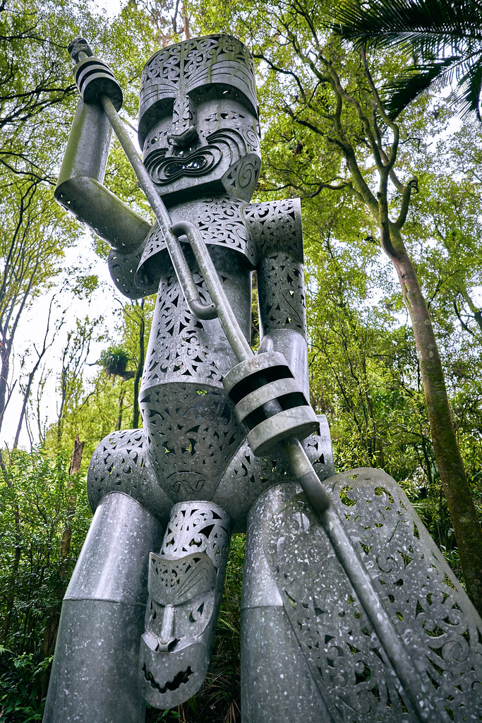
Trampers walk the track in either direction. This route is not a loop, so you’ll need to make arrangements to get to and from the ends of the track, and SH3 road through the gorge was closed in 2017. Alternatively, from the Ashurst end of the gorge, the shorter Tawa loop walk is around 4km in length, and visits the sculpture of Whatonga.
Pororari River Track
- Base: Punakaiki, Westport or Greymouth
- Route length: 7 km return
- Approximate hiking time: 2 hours
- Difficulty: easy
The coastal route between Westport and Greymouth was once named as one of the most spectacular drives in the world by Lonely Planet, and this hike is a great way to break the drive and stretch your legs. Tucked away in the lush Paparoa National Park near Punakaiki, the Poroari River Track is a short hike on a gentle gradient with some spectacular scenery, ideal for first-time trampers.
The trail follows the river through an incredible limestone gorge, with towering cliffs, river-carved escarpments, and karst caverns. The native rainforest is filled with palms and tree ferns that change subtly as you pass from subtropical to temperate zones, with an eerie prehistoric feel, just like the set of Jurassic Park.
It’s possible to extend the walk by joining the Inland Pack Track for a short way, then returning along the Punakaiki river to reach the SH6. There is a small amount of walking on the road to return to the start point, and trampers can also stop by the famous Pancake Rocks.
Hooker Valley Track
- Base: Aoraki/Mount Cook Village or Twizel
- Route length: 10km return
- Approximate hiking time: 4 hours
- Difficulty: easy
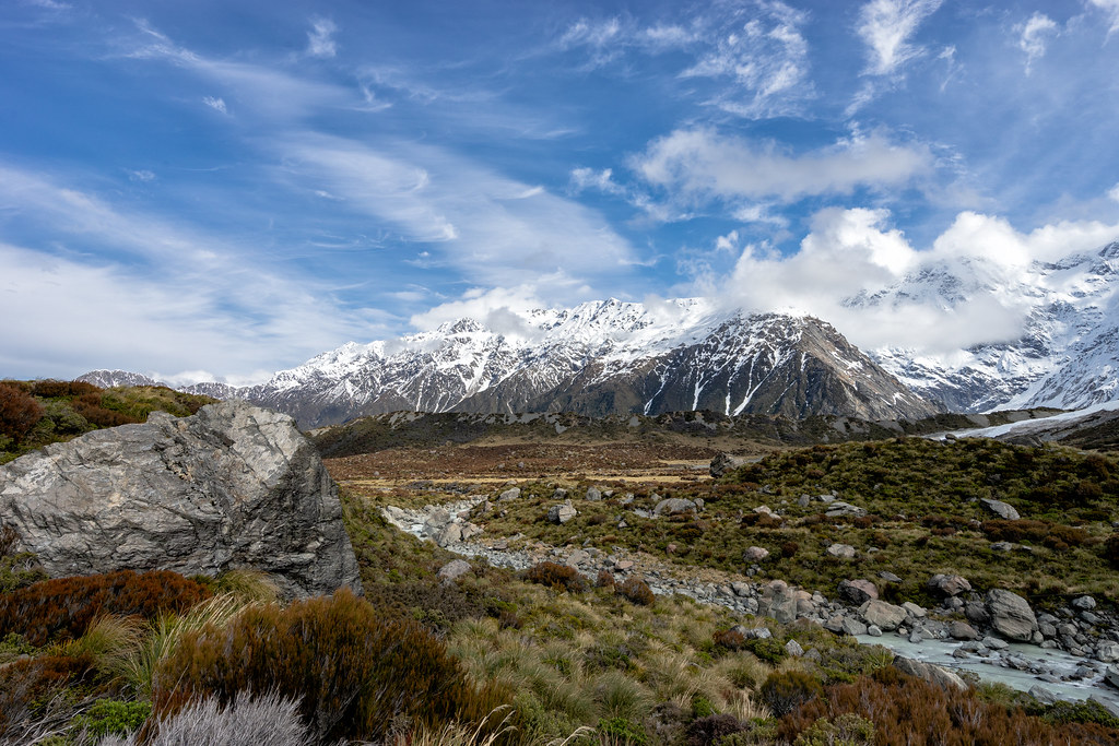
The Hooker Valley Track is short, straightforward, and absolutely sensational. With very little change in gradient or rough terrain along the 5km track to the iceberg-studded Hooker Lake, it’s a perfect route for hiking beginners and families with young children to cut their teeth on before attempting bigger hikes in the area.
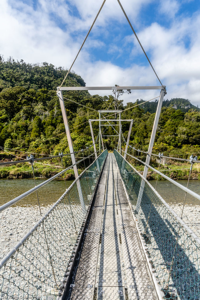
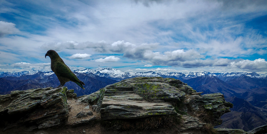
Stunning views of Aoraki/Mount Cook, the highest peak in New Zealand at 3,724 metres (12,218′), against a backdrop of the majestic Southern Alps are just one highlight of the route. Crossing bouncy suspension bridges, spotting endangered keas on the wing, looking for signs of glaciation in the landscape, and listening for the rumbles and creaks of moving ice and snow on the Mueller Glacier make this an especially engaging trail.
The best time to hike is early in the day, when you’ll only see a handful of other hikers, and can catch golden hour alpenglow and the first rays of the sun across the peaks of the Southern Alps / Kā Tiritiri o te Moana.
Ben Lomond Track
- Base: Queenstown
- Route length: 11km return
- Approximate hiking time: 7 hours
- Difficulty: hard
Rising high over the Queenstown streets, Ben Lomond at 1,438 metres (4,717′) is actually a substantially higher mountain than it’s Scottish namesake. The track can be very steep in places, particularly above the saddle, and requires a good level of fitness and experience to complete, including some scrambling to reach the summit.
Trampers looking for a shorter walk can stop at Ben Lomond saddle at 1,000m (3,280′), taking around four hours return, and still take in the spectacular views over Queenstown and Lake Wakatipu, Coronet Peak and the Remarkables mountain range.
The first and last section of the trail can be substituted with a scenic ride on the Skyline Gondola, just a short walk from the centre of town. Otherwise, hikers can follow the Tiki Trail from the Gondola base station or the Skyline access road from Lomond Crescent through the woodland to the start of the Ben Lomond Track. Above 800 metres the track leaves the treeline and passes through tussock meadows to the saddle. The route is marked with orange trail markers, and becomes very exposed towards the summit.
Between May and September, Ben Lomond experiences winter conditions, and it will be necessary to use equipment like crampons and an ice axe on the higher slopes of the mountain. The lower slopes can be slippery and muddy, and trampers should be aware of reduced daylight hours on their walk.
Roy’s Peak
- Base: Wanaka
- Route length: 16km return
- Approximate hiking time: 6 hours
- Difficulty: moderate
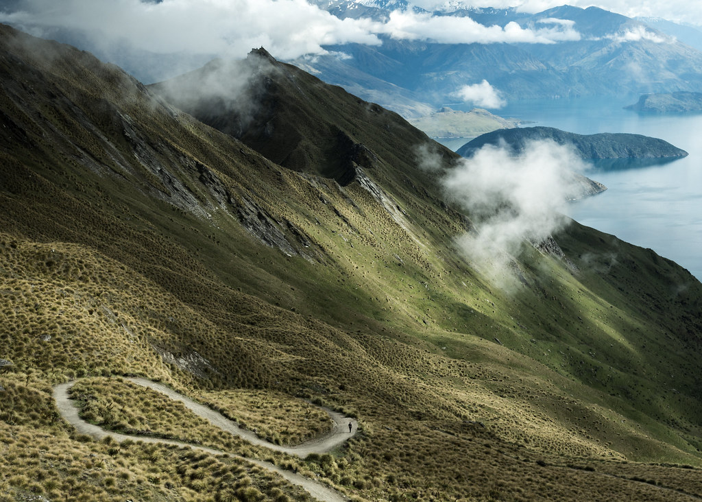
Roy’s Peak is a popular hike for people in Wanaka, with the trail starting just a short distance from the edge of town. Though it’s higher than Ben Lomond, and a longer route overall, the trail is distinct and well waymarked as it zigzags its way to the summit. However, a high level of fitness is still needed to reach the top.
The trail climbs from just above the lakeside through hill farmland into tussock grassland. The insta-famous lookout point is actually around 1.5km from the actual 1,578 metre (5,711′) summit, and many hikers stop at this point. All way up the trail you have views of Lake Wanaka and the backdrop of Mount Aspiring / Tititea and the Southern Alps / Kā Tiritiri o te Moana.
The first part of the track crosses private farmland, and trampers should stay on the track and leave gates as they find them. The trail is closed for a few weeks every year during lambing season, usually from 1st October to 10th November, so make sure to factor this into your plans.
As with Ben Lomond, this route can experience serious winter conditions between May and September, and sections above 1,000 metres can be prone to avalanches. Hikers will need specialist skills and to plan their winter ascent carefully.
Overnight Tramping Experiences
Cape Brett Track
- Base: Russell
- Route length: 16km one way
- Approximate hiking time: 8 hours
- Difficulty: hard (overnight stay recommended)
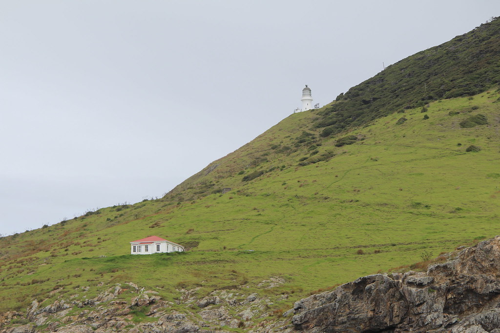
The Cape Brett Track is a rugged route through native and regenerating bush, following a ridgeline that reveals sharp drop-offs and sensational coastal views. Approaching the Cape, trampers could be treated to sightings of dolphins, seals and seabirds close to the shore, and a sidetrack to Deep Water Cove could lead to a snorkel dip on the way.
Live your best lighthouse keeper fantasy by staying in the serviced Cape Brett Hut overnight. Camping is not permitted in the area, and hut stays must be booked in advance. You’ll need to bring sleeping stuff, cooking equipment, food, and in the peak of summer, all drinking and cooking water you might need.
Kauaeranga Kauri (Pinnacles) Trail
- Base: Thames
- Route length: approx. 14km return
- Approximate hiking time: 8 hours
- Difficulty: moderate (overnight stay recommended)
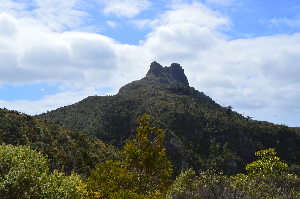
The length of this historic packhorse route means that it could be completed as a one day hike, but the spectacular location of the Pinnacles makes it worth taking your time on the trail. The route is well waymarked, and can be steep in sections. The final ascent to the Pinnacles summit (759m / 2,490′) makes use of climbing ladders to reach the viewing platform.
Take a headtorch to head up to the top early, and watch the sunrise over the Kauaeranga Valley. Drink in the stunning panoramic views of the Coromandel Peninsula, before returning. You can retrace your steps, or make a circuit via Webb Creek and the Billygoat Falls to see the remains of historic logging works, adding an hour or so to the duration of the hike.
Overnight stays in the serviced Pinnacles Hut or in the campsites on the route must be booked in advance, and you’ll need to bring your own sleeping stuff and food. The trail car park is just a 2-hour drive from Auckland, so it can be very busy during the peak season.
Abel Tasman Coast Track (Mārahau to Anchorage)
- Base: Nelson
- Route length: 12.5km one way
- Approximate hiking time: 5 hours
- Difficulty: easy (overnight stay recommended)
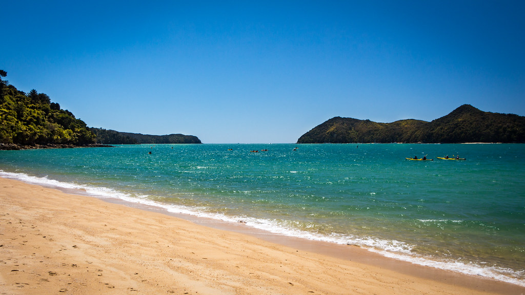
The Abel Tasman Track is one of the most well-known of New Zealand’s Great Walks, threading its way along the spectacular coast of the Abel Tasman National Park. The full track leads from Mārahau to Wainui in Golden Bay is 60km, and takes between 3 and 5 days to complete.
This section of the track is a gentle hike through native bush, stunning beaches, rocky gullies, and granite islands, where you might spot a fur seal basking in the sun. The well-worn path means that it can be busy at times, but solo travellers are guaranteed to meet someone to walk with.
The hike ends at beautiful Anchorage Bay, stopping just before the first low-tide crossing. Starting early leaves plenty of time to explore sidetracks, such as Cleopatra’s Pool, or to relax on the golden sand beach.
Trampers can stay overnight in the Anchorage Hut or in one of the campsites on the route, which must be booked in advance all year round. You’ll need to bring your own sleeping stuff, cooking equipment, and food. Alternatively, return to Mārahau or Kaiteriteri by water taxi, ready for your next adventure.
My tips for day hikes in New Zealand
Whether you choose to take on one of these day hikes, or one of the many others that New Zealand has to offer, there are a few things to bear in mind.
- Plan your route ahead of the walk. The Adventure Smart website has excellent resources to help you get started.
- ViewRanger with Land Information New Zealand (LINZ) Maps is invaluable for reading the terrain, and the Department of Conservation website has excellent route descriptions and photos.
- Check the weather using the MetService forecast. An essential part of preparation, and can be the key difference between a rewarding hike or an endurance slog.
- High factor sunscreen is always an essential for me, but New Zealand has a depleted ozone layer and the effects of the sun are felt more keenly, so sunglasses and a wide-brimmed hat are also vital.
- It goes without saying, but all rubbish should be taken away with you and disposed of safely. If you carry it in, you can carry it back out again.
- Be aware of toilet facilities on a trail, and plan accordingly. Make use of public toilets in local settlements, and long-drop toilets provided at trailheads, huts, campsites to avoid contaminating waterways.
- If you’re hiking solo, be sure to let someone know where you’re going, when you plan to return, and when you’re back safely. An Outdoor Intentions form is a great way to do this.
What to wear on a day hike in New Zealand
New Zealand weather famously inspired the phrase four seasons in one day. Layering your clothes helps manage your comfort in changeable conditions, and you can find more tips here.
- Walking trousers or shorts.
- Base layer and t-shirt.
- Hiking boots or sturdy trail shoe.
- Hiking socks.
- Packing a waterproof jacket and trousers is always a good idea.
- Take a warm top or fleece to keep you warm when you stop moving.
What to else do you need to hike?
- A reasonably sized day pack, 20-25 litres, should be sufficient to hold everything you might need.
- Take plenty of water. It’s important to keep hydrated on a hike, and you could be out for longer than expected (or just want to make a nice cup of tea with a view while you’re out).
- Enough high energy snacks and food to keep you energised for the duration of the hike. Trail mix, known as scroggin in New Zealand, is an excellent choice.
- Take a map and compass when you head out into a remote area; not all trails are clearly defined, and you may need to rely on these in poor visibility. And GPS is not infallible.
- A head torch, especially if you’re on a longer hike or planning early starts and late finishes.
How to make it an overnight hike
- Take a sleeping bag (and a tent if you’re not staying overnight in a hut), which means you may need a larger backpack. Around 30-45 litres, should be enough.
- Cooking equipment, like a stove and gas, plus cooking pots, bowl, mug, and cutlery.
- Additional food for an evening meal, breakfast, and snacks for the following day.
- Sealable bags to securely store all your waste until you get back to your base. All rubbish must be removed from huts or campsites when you leave.
- Some warm clothing to wear at your camp, including a warm hat and socks.
Winter hiking
Winter hiking in New Zealand is serious, especially in parts of South Island. Conditions can be gnarly, especially in remote areas, and there are some additional hazards you may encounter. It’s important to be properly prepared, and that may mean taking an ice-axe and crampons, and having the skills and experience to use them.
It also means taking additional time to research and assess information about your chosen route; backcountry weather, reduced daylight hours, the terrain and underfoot conditions, and avalanche forecasts. And remember that sometimes the best decision you make is the one to turn back.
So what do you think? Do any of these trails take your fancy?
Have you done any of these sensational tramping tracks? Do you have any tips for top tramping times in New Zealand?
Let me know what you think in the comments below.
Inspired by these ideas? Why not pin this post for later?

2 thoughts on “11 Great Day Hikes in New Zealand”