At 1,038 metres (3,547′) Schiehallion isn’t especially close to Ben Nevis in height, but it is certainly one of the most iconic Munros. The distinctive, near-symmetrical profile of the mountain attracts hikers from both home and away looking to experience the great outdoors, and it’s a great choice for first time Munro baggers.
Schiehallion
In the heart of Highland Perthshire, close to the very centre of Scotland, Schiehallion has the reputation of being both one of the most mysterious of Scotland’s mountains, and the most measured. The name Sidh Chailleann translates from Scots Gaelic as “the fairy hill of the Caledonians”, and it’s not difficult to find traces of folklore and superstition on the slopes of Shiehallion.
Reach the summit on a summer evening, and you’ll be enchanted by views of Loch Tummel and Loch Rannoch stretching out towards the vast blanket of Rannoch Moor in the gloaming. Descending through the dusk you’ll catch mysterious sounds reverberating across the hillside: secret whisperings of the wee folk, or magical drumming snipe and roding woodcock?
Planning my route
I was taking part in the 2019 TGO Challenge, a coast-to-coast crossing of Scotland on foot, and wanted to include a few mountains on my route from west to east. As it happened, dropping a few planning pins into my ViewRanger map put one close to the peak. After a few days of low-level walking, I reckoned I’d be limber enough to take on the mountain and make a west-to-east traverse of Schiehallion.
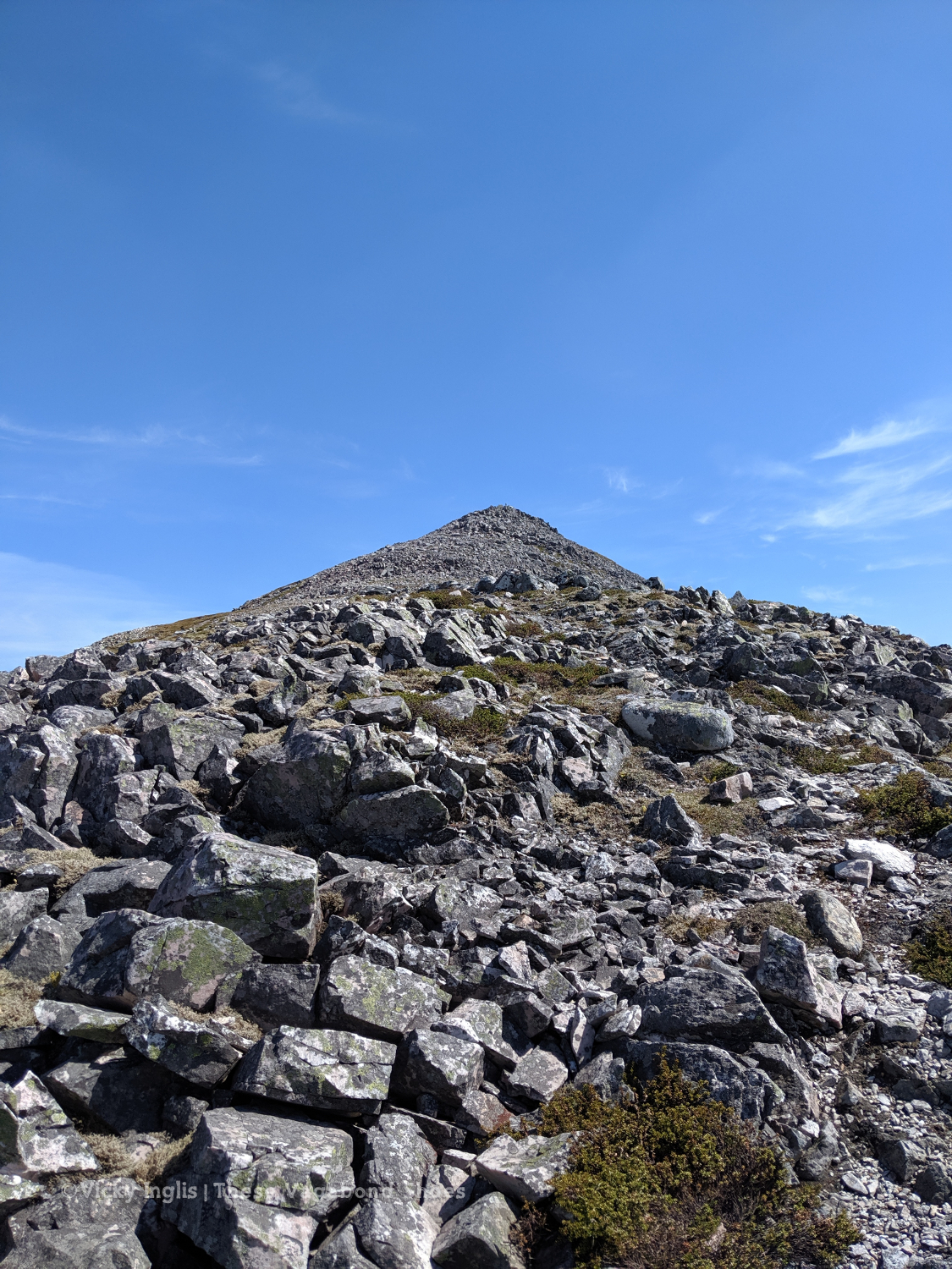
From the east and west the peak looks like a perfect pyramid; from north and south, a long whaleback ridge with a more gentle rise to the top. It stands in isolation, easily picked out on the skyline ahead of me as I left Glencoe and crossed Rannoch Moor.
Schiehallion Traverse
- Start Point: East Tempar Farm*
- Finish Point: Braes of Foss
- Distance: 10km
- Hiking time: 4 hours
- Difficulty: Moderate
- Map: OS Explorer OL49
*Note: There is nowhere to leave a vehicle at East Tempar. Parking is available at Braes of Foss carpark (approx. 7km on the road) or in Kinloch Rannoch (approx. 3.5km on the road). I walked along the road from Kilvrecht Campsite, approximately 9km.
The glorious May weather had stayed another day, so despite not being in any particular rush to get underway, I’d been up since 6am with the sunshine, packed my tent (shaking off drifts of tree pollen that had accumulated through the previous evening), loaded up with drinking water, and hit the road to get to my starting point for 9am. Find a route map on my ViewRanger.
From East Tempar Farm a hill track rises gently through sheep pasture, gaining around 350m in a little over two and a half kilometres, to the base of the towering west flank of the mountain. The track continues on to the tumbledown shielings at the col at the head of Gleann Mor, the dale between Schiehallion and the Can Mairg hills to the south.
Gleann Mor is reputedly just as magical as the mountain that looms above. According to legend, the fairies of Schiehallion make their home in Uamh Tom a’Mhor-fhir, a cave in the upper reaches of the glen, and the doors leading into Elfhame (fairyland) marked by tussocks of white heather.
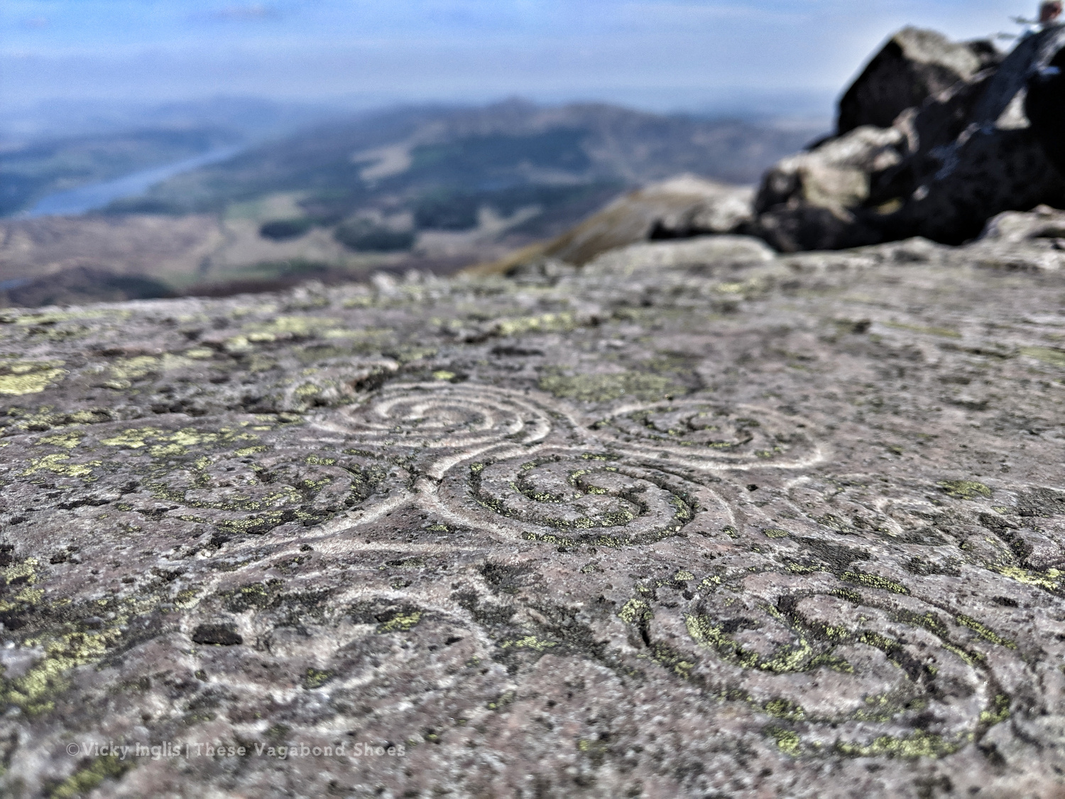
There might be little real evidence of fairies on Schiehallion, but the region wears its history close to the surface. Old shielings are a reminder of the traditional cattle grazing way of life in highland glens, and traces of hut circles and ancient cup-and-ring marked rocks a connection to a more distant and mysterious past.

My route led upwards, over rough ground cut only by deer tracks contouring the slope. I snapped a couple of quick pictures, along with some of some grouse droppings, to perpetuate the haggis myth with which we were teasing my French and Romanian crewmates. Haggis is “…un cochon d’Inde écossais indigène. C’est vrai.” True fact.
There wasn’t a breath of wind when I reached the first boulder field, a patch of fractured quartzite exposed amongst the heather tussocks and spongy lichens. Higher above, the first false summit of my climb marked the point where the vegetation began to yield to the rock, with just sparse turf between the boulders.
The Schiehallion Experiment
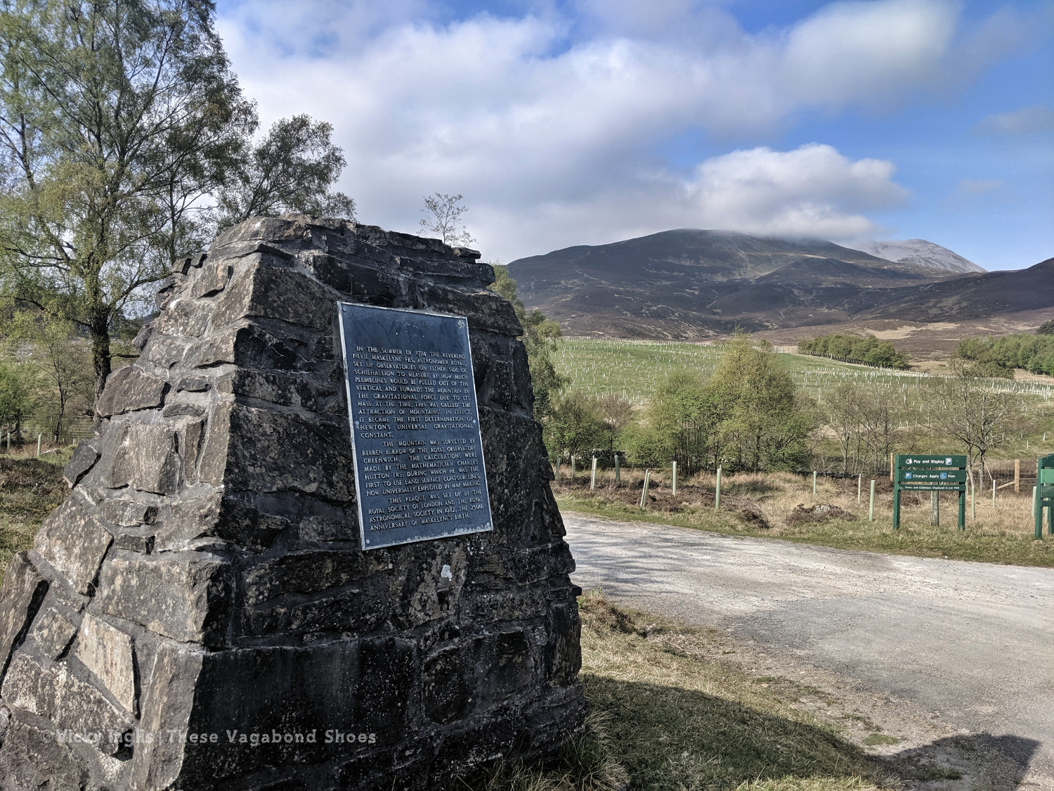
The splendid isolation and arresting symmetry of Schiehallion caught the attention of the Royal Society as a place to observe the “attraction of mountains”. In the summer of 1774, Astronomer Royal Nevil Maskylene and surveyor and mathematician Charles Hutton gathered data on the tiny deflection of a pendulum against the position of the stars, revealing the gravitational pull of the mountain.
Between astronomical observations and a survey of Schiehallion’s shape and composition, the experiment provided evidence of Newton’s theory of gravitation, and of the density and shape of the entire planet. During the development of the experiment, Hutton pioneered the concept of contour lines to show relief in cartography, helping me greatly with my TGO challenge route planning.
The Schiehallion experiment is commemorated by a plaque at Braes of Foss, and the eagle-eyed can spot the footprints of Maskylene’s parallel observatories on the north and south flanks of the mountain.
The Summit
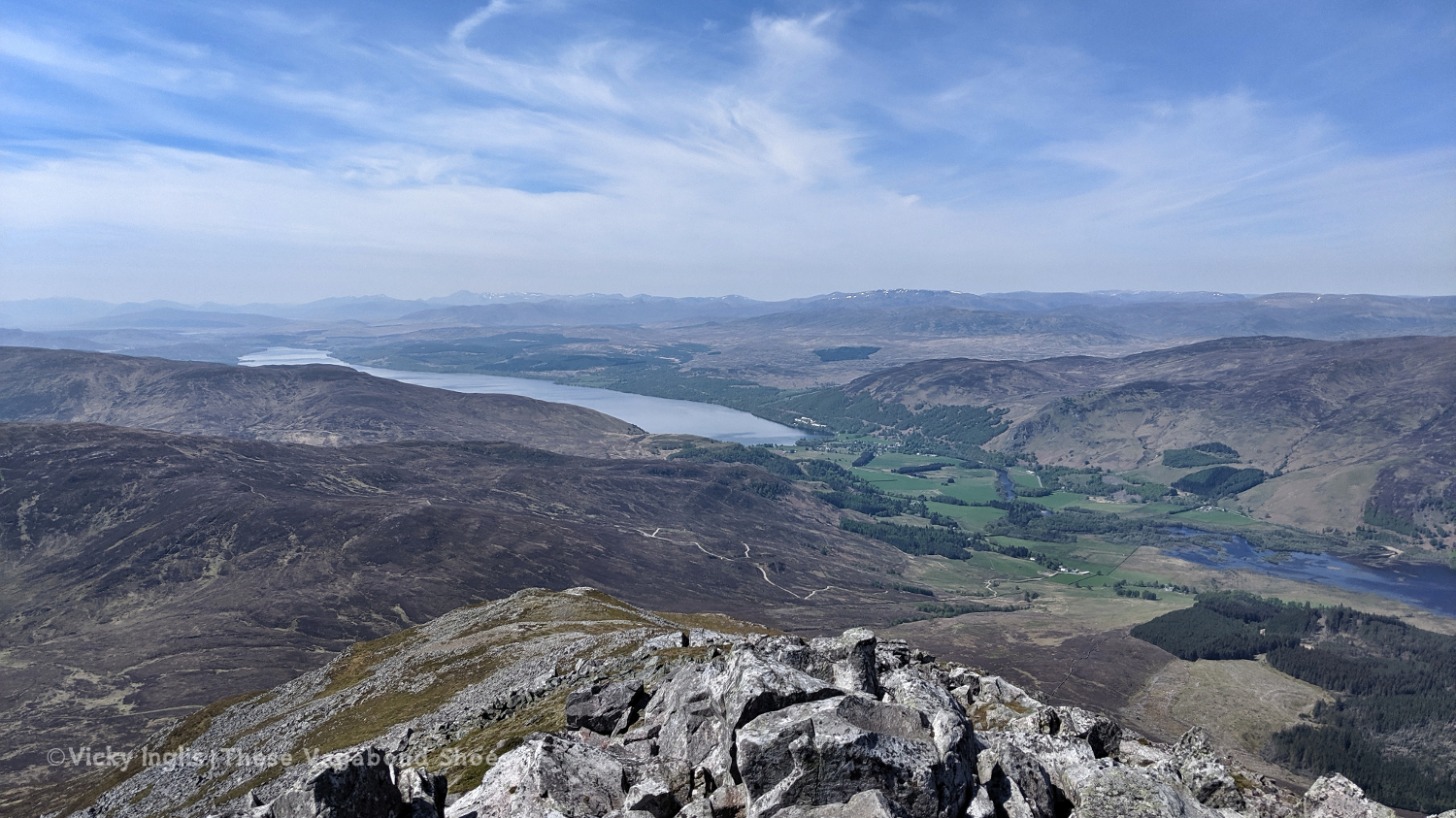
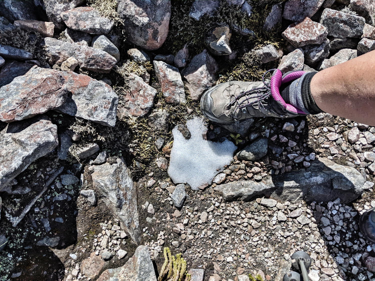
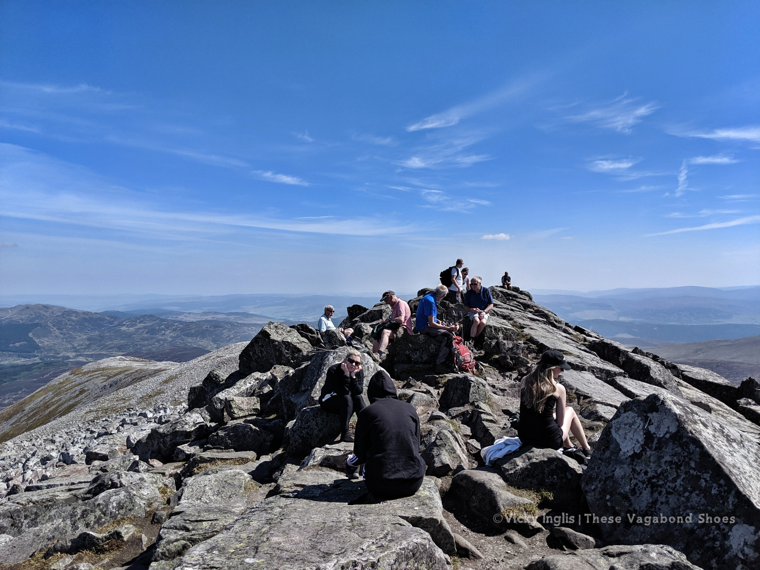
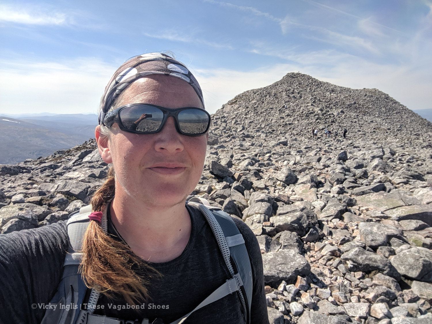
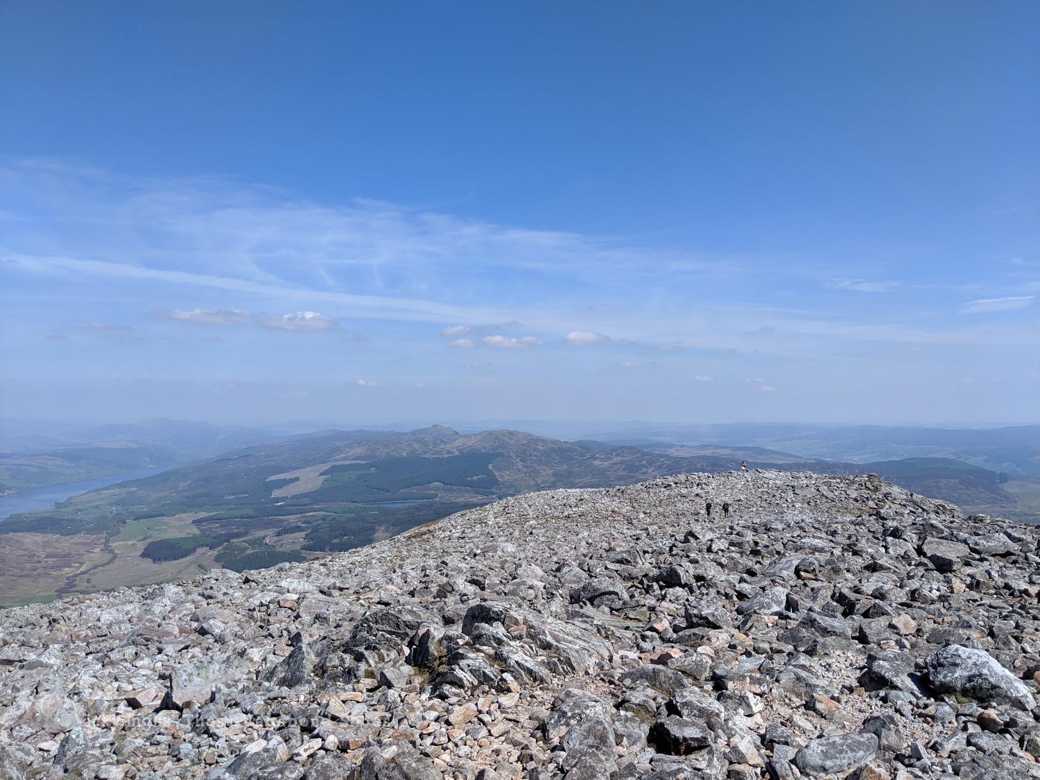
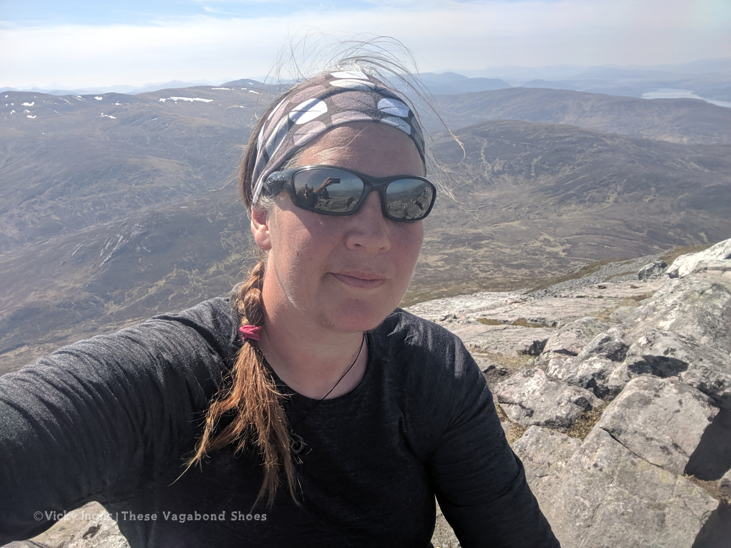
Into the boulder field proper, the true summit rose up behind the last false peak, identifiable this time by the small gathering of people on the rocky outcrop. Tucked into hollows on the northern side of boulders were tiny patches of snow, none larger than my backpack, holding on in the 20°C heat. I scrambled up the last six or seven metres to the top, and turned to take in the view that had been at my back during the climb.
From the summit, I could see across the Tay Forest and Loch Tummel to the Beinn a’Ghlo in the east, south to Ben Lawers, and north to Ben Alder. But the view to the west was the best. The eye skims along the shining surface of Loch Rannoch into a golden-blue haze over Rannoch Moor. On the edge of visibility, I could just make out the Black Mount and Glencoe, where two days ago I’d caught my first glimpse of this peak.
I took a long break to rehydrate, and devoured a packet of Tuc sandwich biscuits that were by now mostly cheese-flavoured dust. This won me the friendship of a springer spaniel called Saoirse, waiting with her dog-dad for the rest of the family to join them at the top. I hunted around and found the spiral carving in the rock. More likely a modern addition than ancient art, but still a reminder that for many the mountains are spiritual spaces.
Descent
The route across the boulder field was indistinct, but the following the ridge easterly with the natural compass of the sun was moving in the right direction. Skipping over the loose rock in the boulder field for a couple of kilometres, trying unsuccessfully to pick my way along Saoirse’s chosen route, I found a worn track and reached the top of the path. The way down was much simpler than the way up, dropping down the flank of the mountain on a well-surfaced route.
I reached the carpark at Braes of Foss in mid-afternoon, glad to be able to refill my water supply and find a spot of shade for a cuppa and spoonful of peanut butter. It had been another long, draining hike in the sun. I still had another few kilometres to go to reach the end of my planned route for the day, to the access road for Foss mine, where I was to meet my lift.
On the way round the road, I decided that the TGO Challenge could wait for another day, and rescheduled my rest day for the next morning. I’d take the chance to buy some sunblock, and just enjoy the shade for a while. It was a real treat to get into Pitlochry that evening, pick up a takeaway and some cold beers, and sit in the garden of my friend’s house celebrating reaching half-way across Scotland on the top of that magical mountain.
Schiehallion East Path
- Start / Finish Point: Braes of Foss carpark (£2/full day)
- Distance: 10km return
- Hiking time: Usually between 3 and 4 hours (depending on how long you enjoy the view for!)
- Difficulty: Easy to moderate
- Map: OS Explorer OL49
Most hikers visiting Schiehallion follow a different route to the one I took, starting and finishing in the carpark at Braes of Foss, and following the East Schiehallion path. In a rare case of mountain rescue, where the mountain itself was the casualty, the path was constructed by the John Muir Trust to manage erosion and protect delicate vegetation on the lower slopes of the mountain. Find a route map on my ViewRanger.
The route is clear and obvious, though there is no waymarking, tackling the east ridge of the mountain in zigzags that avoid expanses of bog but still gives hikers glimpses of wildflowers and bog plants. The area is also home to wildlife like red deer, black grouse, and ptarmigan.
After around 3.5km the path reaches the boulder field on the top of the ridge. Here the route is undefined to the summit, crossing loose rocks and scree, so care and attention to navigation is needed over the final 2km, especially if visibility is reduced.
Incredibly, thanks to an initiative by the FieldFare Trust, the first third of the route has been approved as wheelchair-friendly, with the remainder of the route to the summit deemed accessible at an individual’s discretion, making Schiehallion the first wheelchair-accessible Munro in Scotland.
Descend by retracing your steps to the boulder field to the path, and return to the carpark.
What to wear for hiking in Scotland
Though the warm, windless conditions on the day of my hike suited shorts and a t-shirt, that’s not what I would usually recommend for a day in the Scottish mountains. The best clothes for hiking are thin, quick-drying layers, and well-fitting, supportive boots.
The temperature can be quite different once you reach the summit, and a good rule of thumb for planning is that for every 300 metres (1,000′) it will be around 2°C colder. On a windy day, this will feel even more.
Walking trousers are robust but breathable, and usually have good pockets for gadgets and snacks. Shorts will normally be ok in fine weather, but if you’re going to venture off the beaten path and bash through the heather it can be uncomfortable. Gaiters will help protect your trousers and keep them dry and clean. They also double up as a dry mat for sitting on the ground when you stop for breaks.
A waterproof jacket and pair of trousers are always a good idea in Scotland. Even if there’s no rain in the forecast, conditions can be unpredictable, and a waterproof layer can break the chill of the wind.
A fleece or light sweater will keep your core temperature toasty when you reach the top. A warm hat, buff and pair of gloves will be useful in most conditions, but don’t underestimate the sun. There’s no opportunity to escape into the shade on most Scottish mountains. A broad-brimmed hat and something covering your shoulders could be important in summer to prevent heat exhaustion.
What other equipment will you need?
- A backpack to carry your gear (with a waterproof cover)
- A map and compass (and GPS)
- Walking poles – optional
- A good supply of water and snacks.
Tips for solo hiking
- Be prepared for the hike with the right clothing and equipment.
- Plan your hike in advance, and work out the time you will need, factoring in breaks on the way.
- Always take a map and compass, and know how to use them. Even if you use a GPS.
- Tell someone where you are hiking, and remember to let them know once you’re back safe.
Planning to hike Schiehallion and inspired by what you’ve just read? Why not pin this post for later?

This looks like a fabulous hike. I particularly liked the stories about the fairies. I’m filing this hike idea for when I visit Scotland.
Schiehallion look stunning! This makes me really keep to come back to the UK and explore some Munroes! What amazing views- and it looks like you had the perfect day! It’s a shame that you had to celebrate with cheese dust! You need a lunch for champions to accompany those mountains.
p.s. I have a dappy question for you, how to you pronounce the “Shie” part of Schiehallion? Is it “shy-e” ?
Good question! There’s some variation with different Scottish regional accents, but I’d sound it like “Shee-hal-yun”. This guy says it as they would do a bit further south of where I’m from: https://forvo.com/word/schiehallion/#en
Scotland is such a gorgeous place–I’d love to go back again someday to do more hiking! The marked/ringed rocks look so cool! I love the story about the fairies–I got to go to the Fairy Glen + the Fairy Pools when I went! :]
There’s a lot of really fascinating folklore and fairy tales connected to the Scottish landscape. There’s a small loch in the Cairngorms that is said to get its green water from the fairy folk washing their clothes in it!