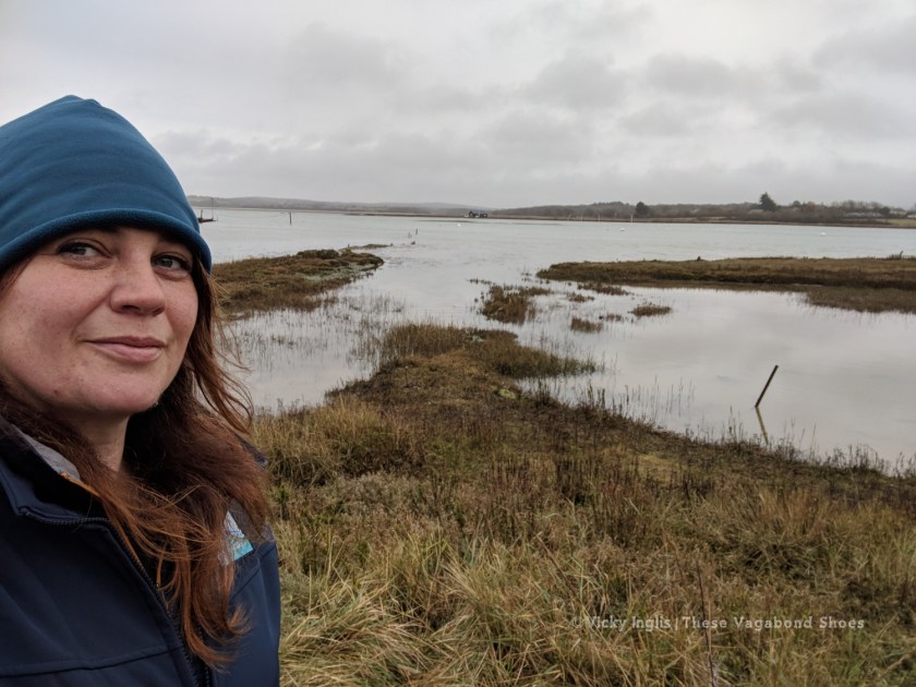
I’ve been fortunate to spend a few years living and working on the Isle of Wight, and covering some of the most beautiful stretches of coastline in the south of England as a Wildlife Ranger. As days grow shorter and temperatures grow colder, the island’s beaches, creeks, and estuaries seem to look even more beautiful, whatever the weather, and become havens for thousands of overwintering birds. Without the numbers of tourists that visit in summer, exploring the Isle of Wight in winter often means have beautiful coastal walks all to yourself.
Western Yar Estuary
- Route length: 7km (4.5 miles) circular route, with the possibility of an extension to make 11km (7 miles)
- Difficulty: easy
- Start / Finish: Yarmouth
The Western Yar is a snapshot of the geological past of southern England, a remnant of a much larger river rising from the chalk downland that once stretched from the Needles, at the tip of the Isle of Wight, all the way to Old Harry Rocks on the Dorset coast. Now, a small stream quickly becomes a vast tidal estuary, edged with mudflats and saltmarshes that support hundreds of waders and wildfowl.
Find details of this circular walk from Yarmouth, Isle of Wight, including a route map, on my ViewRanger.
The riverside path from the harbour passes the old mill and joins the old railway line that once linked Freshwater and Yarmouth to Newport. Listen for the whistles and whoops of teal and wigeon, and the piping calls of oystercatchers from the estuary mud. The walking is pleasant and easy, with small birds flitting between the hedgerows lining the trail. The copse further on is a good spot to look for red squirrels scampering overhead.
The walk can be extended from the Causeway towards the narrow ridge of chalk downs, and the coast known as the Back of the Wight. A short distance on footpaths and minor roads takes you past Afton Marsh Nature Reserve towards the golf course. To your left, you’ll catch a glimpse of the Old Military Road, with the crumbling coastline below, and to your right, it dips down to Freshwater Bay before rising sharply toward Tennyson Down.
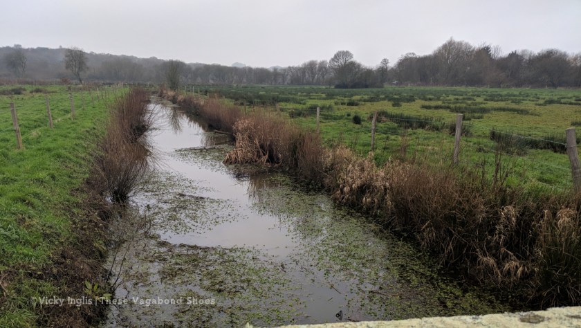
Rather than retrace your footsteps, a winding path leads down the side of some houses, alongside the early stages of the river Yar, passing through thick reedbeds back to the Causeway crossroads.
From the Causeway, turn left and find the footpath that runs between the Red Lion pub and All Saints Church. The path leads northwards, away from the edge of the estuary, across rolling farmland and through the woods. Look out for views across the Solent to the New Forest as you leave the woodland behind.
Cross the swing bridge and finish the walk back in Yarmouth by the harbour. Pop into PO41, one of my favourite spots on the island for coffee and home-made cake to finish the day.
Newtown Creek
- Route length: 5km (3 miles)
- Difficulty: easy
- Start / Finish: Newtown National Trust Visitor Centre
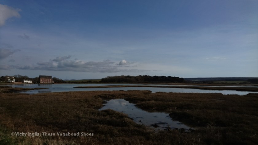
One of the most beautiful and historic parts of the Isle of Wight, Newtown was once a thriving medieval port, the most important on the island, with a bustling saltworks and several streets of houses. But after centuries of ebb and flow, Newtown Creek is now a quiet backwater that, in winter, bustles only with birdlife. In the 1960s plans to locate a nuclear power station here were protested by the local community, and led to the creation of Newtown Harbour National Nature Reserve.
Find details of this walk around the Isle of Wight’s finest nature reserve, including a route map, on my ViewRanger.
From the National Trust carpark, cross a minor road and follow the route of the medieval street eastwards. The track opens out into a beautiful area of pasture, with several ancient oak trees (and the entrance to the Upside Down), which is grazed by heritage cattle at certain times of the year.
Leave the field at the far side, turn right then follow the road for around 200m to enter Walter’s Copse, a pocket-sized wood with both ancient woodland and rotational coppice management, that edges onto the saltmarsh of the creek. Follow the trail through the wood and back to the road. Turn left, then right, to retrace your route to the Visitor Centre.
Continue on the road past the church, then take the track at Marsh Farm to reach the Mercia Seabrook hide. National Trust volunteers will open the hide on selected days during the winter, and lead guided walks to show visitors the spectacular winter birdlife; look for hundreds of golden plovers, diminutive dunlins, and a variety of ducks. Grey seals often lounge on the shingle spit on the far side of the creek.
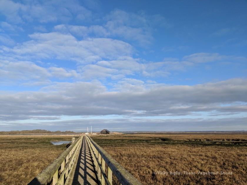
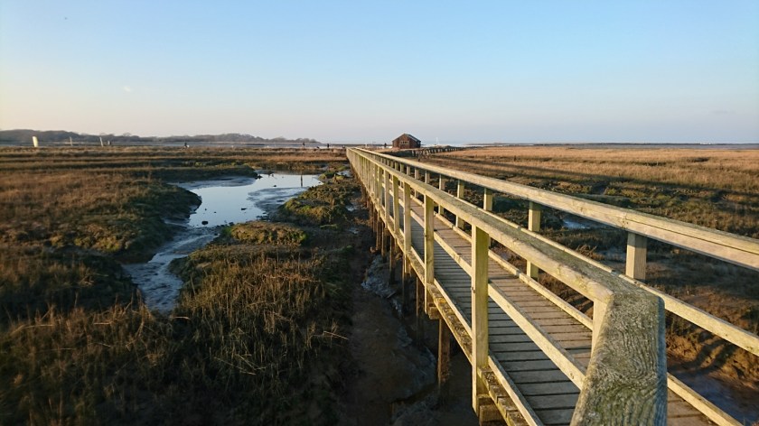
Cross the field to reach the wooden boardwalk leading to the old boathouse, which has views across the creek and out to the Solent beyond. A path leads around the edge of the historic salt pools, and back to the hedgerow-lined meadow. On a crisp winter morning, with the purring sound of brent geese filling the air, it’s a pretty magical place to visit.
Brading Marshes and Bembridge Mill
- Route length: 10km (6.2 miles)
- Difficulty: moderate
- Start / Finish: Brading
Brading was once a busy fishing port, and the coastal village of Bembridge, just a couple of small farms on an isolated peninsula. Land reclamation along the estuary of the Eastern Yar* over 120 years ago moved the coastline downstream several miles, creating a sheltered haven between Bembridge and St Helens.
Find details of this walk at one of the best birding sites on the Isle of Wight, including a route map, on my ViewRanger.
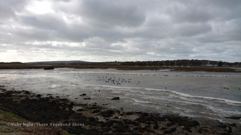
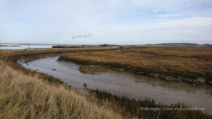
From Brading, follow the road towards the RSPB reserve, then bear left onto Laundry Lane. This raised track looks over into marshes and scrapes that fill with waders and wildfowl through the winter. At the end of the lane, bear right on the edge of the main road into St Helens village.
Head downhill from St Helens village green to the embankment, then bear right onto the footpath through the edge of the RSPB reserve. The trail runs alongside a series of saline lagoons, attracting shorebirds seeking refuge over the high tide in the harbour.
From the Tollgate, which has great views across the harbour to the area of sand dunes known as the Duver, follow the road up through the pretty village of Bembridge. Take the road on the right after the church and the library, leading out of the village towards Bembridge Mill.
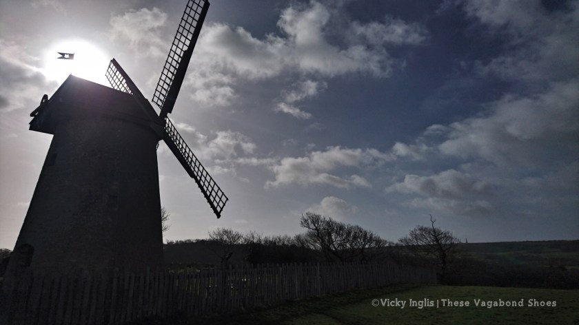
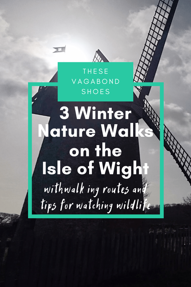
Picturesque Bembridge Mill is the only surviving windmill on the island, falling out of use in the early 20th century and used as a Home Guard lookout during WWII, before being restored to working condition by the National Trust.
Enjoy the views before heading downhill from the windmill, following the line of the old sea wall, across the edge of Bembridge Airfield, and into Centurion’s Copse, a red squirrel hot spot. Bear right, and pass through the RSPB reserve. The ditches and sluices allow for careful control of water levels to manage one of the most important wetland areas in southern England.
At the end of the old sea wall, you’ll meet the end of Laundry Lane, and be able to retrace your steps back into Brading. Pop into the Auctioneer for a pot of tea and a huge wedge of cake, and even a browse through the latest selection of antiques and curios on display.
*The Isle of Wight has three large-ish rivers. Two of them are called the Yar. The story is that no islanders ever travelled the vast distances from Bembridge to Yarmouth (about 45 minutes drive now), or the opposite direction, so the lack of imagination in naming never really mattered.
Tips to watch wildlife responsibly in winter:
- Avoid causing disturbance to birds feeding or resting in coastal areas.
- Bring binoculars for a good view without getting too close.
- If the birds become alert and stop feeding on mudflats and saltmarsh, move further away and allow them to settle down.
- Stick to paths and marked routes where they exist, and avoid emerging suddenly onto saltmarshes and creeks.
- Stop for a while on your walk, or move slowly, to see what emerges from nearby hedgerows or reedbeds
- Listen to the sounds; they might reveal something you would otherwise miss.
- Always follow guidance on signs on sites.
What to look out for:
Birds: dark-bellied brent geese; greylag geese; golden plovers; curlews; oystercatchers; black-tailed godwits; lapwings; dunlin; pintail; teal; widgeon; shelducks; kingfishers; peregrine falcons; rooks; yellowhammers; short-eared owls; little egrets; spoonbills; long-tailed tits; goldcrests; fieldfares; redwings; ravens.
Other creatures: Hebridean sheep; belted Galloway cattle; red squirrels; grey seals.
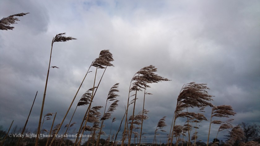
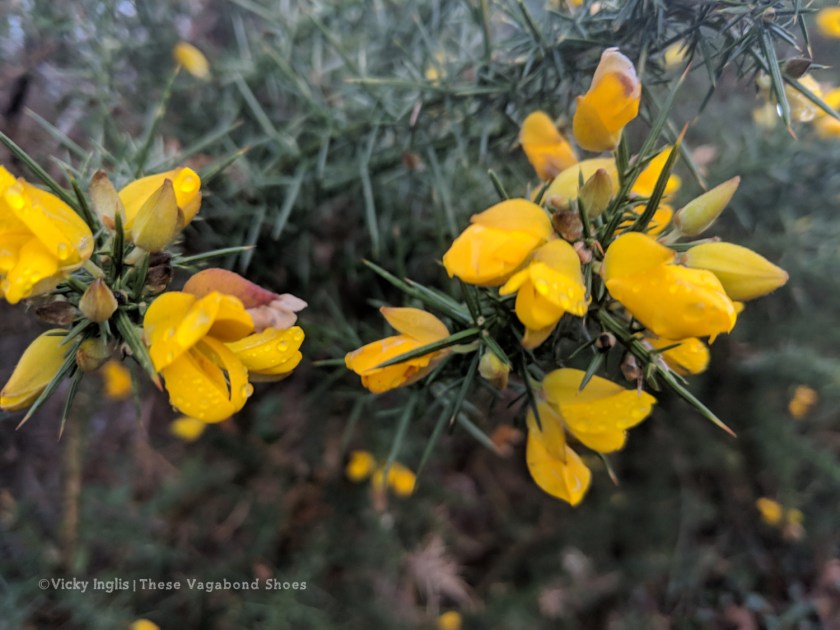
Nature: Ancient oak trees; coppice hazel and the first catkins; an abundance of fungi and lichen; towering reedmace and phragmites; brambles; spindle berries; gorse flowers.

Photos and the article itself are just wonderful! My family was fully vaccinated, and we are looking for our first place to go when this whole pandemic would be over. We are just looking forward for it to happen. Maybe the Isle of Wight is the place we should visit. Thank you for an inspiration!