
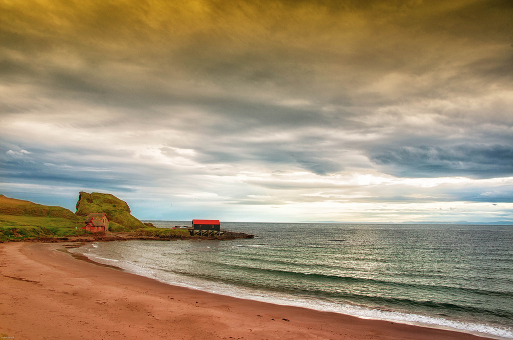
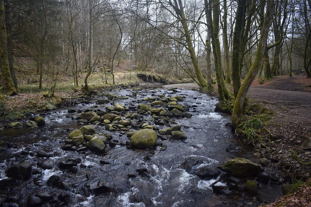
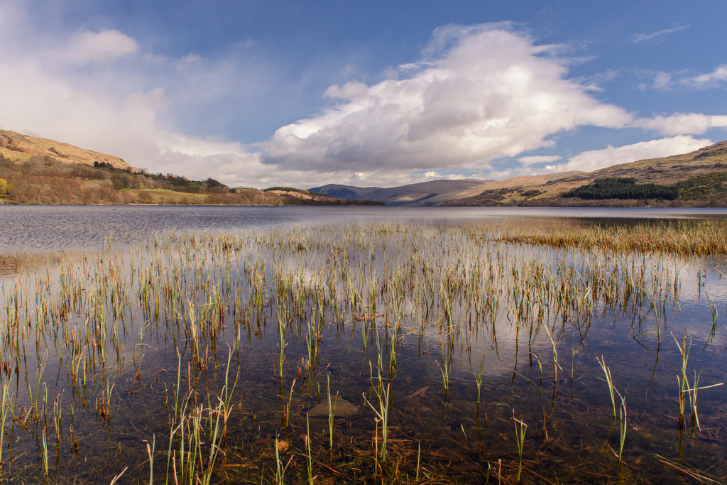
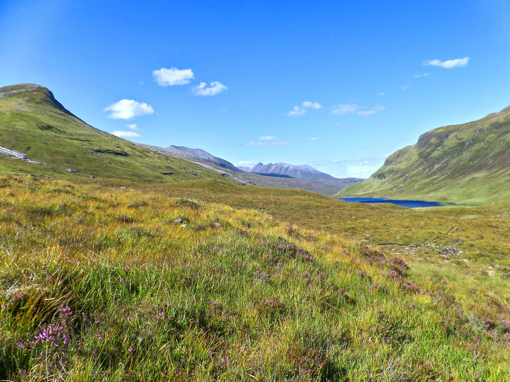
You could walk for 500 miles, and then you would walk for 500 more. That’s just how beautiful Scotland is. Sweeping, wide-open moors, historic castles, picturesque lochs, ancient forests, and craggy mountains form the hauntingly beautiful backdrop for some of the finest long-distance walks in the UK.
But enough havering; Scotland’s long-distance routes are a fantastic way to get outdoors, and explore some of the country’s most spectacular landscapes on foot. Not only that you’ll also be treated to close encounters with nature, the freshest air, and the freedom that comes with being out in wild and remote areas.
Just because these routes take multiple days to complete, don’t be put off by the thought of not having enough time. The trails don’t have to be completed in one go and can be broken down into bite-sized chunks to fit into weekends and single days that are just as enjoyable.
Read: 8 Great Day Hikes in Scotland
Here are, in my opinion, the greatest of the long-distance trails in Scotland. The routes vary greatly in character, from waymarked cross-country trails like the ever-popular West Highland Way to unofficial, often pathless, challenges aimed at experienced backpackers, like the Cape Wrath Trail.
The West Highland Way (WHW)
- Start: Milngavie
- Finish: Fort William
- Length: 154 km (96 miles)
- Average time to complete: 7 days
- Difficulty: moderate (Devil’s Staircase is hard)
The first, and far away most famous, long-distance trail in Scotland, the WHW stretches from Milngavie, on the edge of Glasgow, to Fort William, dubbed Scotland’s outdoor adventure capital, 154km (96 miles) to the north.
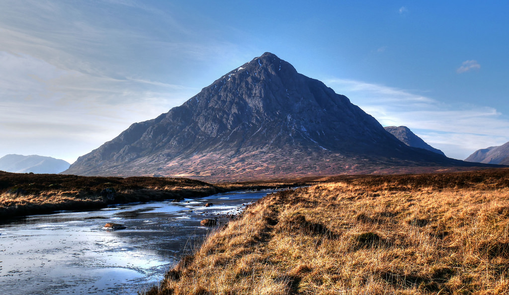
The route crosses the rolling Campsie Fells into Loch Lomond and the Trossachs National Park, following the bonnie banks of the loch into the increasingly craggy highlands. It crosses the starkly beautiful Rannoch Moor into atmospheric Glencoe, before climbing to the highest point of the trail, the Devil’s Staircase, and onward to finish at the foot of Ben Nevis, the highest mountain in the British and Irish Isles.
The route is well waymarked, and has plenty of opportunities for re-supply stops, tearooms, and pubs on the way, with Kingshouse the most popular. Hiking is easy going for the main part, and largely avoids the high ground; Ben Lomond and Ben Lui, in Loch Lomond and the Trossachs National Park, Black Mount and the Mamores can be added to the route, and it can finish with the summit of Ben Nevis (1334 metres) if your legs feel up to it.
Great Glen Way (GGW)
- Start: Fort William
- Finish: Inverness
- Length: 117 km (73 miles)
- Average time to complete: 6 days
- Difficulty: easy to moderate
Tracing the major geological faultline that cleaves Scotland in two, the GGW links the highland towns of Fort William and Inverness, largely following a string of lochs linked by the Caledonian Canal.
The faultline divides the Grampian Mountains to the south from the Northwestern Highlands, some of the oldest rocks in the world. Starting in Fort William, the route passes Neptune’s Staircase, an impressive flight of locks built by engineer Thomas Telford linking the Canal to Loch Linnhe and the sea. It follows the lengths of Loch Lochy, Loch Oich and Loch Ness* on forestry roads, before passing the pretty Isles of Ness and finishing in Inverness city centre.
The route is well waymarked, and the hiking is straightforward throughout, though it gets steep in the forests over Loch Ness. Between Fort Augustus and Drumnadrochit there is a high-level alternate route, which has spectacular views over Loch Ness and along the rest of the Great Glen. It can also connect with the West Highland Way and Cape Wrath Trail in Fort William and the Affric Kintail Way in Drumnadrochit.
*Bring some monster spotting binoculars, and you might be rewarded with sightings of anything from red squirrels to red deer, ospreys and even otters.
Southern Upland Way (Scotland’s Coast to Coast)
- Start: Portpatrick
- Finish: Cockburnspath
- Length: approximately 341km (211 miles)
- Average time to complete: 14 days +
- Difficulty: hard
The longest of Scotland’s great trails, and the original coast to coast walk, this trail starts in the pretty village of Portpatrick on the west coast and finishes on the North Sea coast in Cockburnspath.
The route follows forestry trails through the Galloway Forest Park, famed for its dark skies, and into the open moorland and rugged hills of the Southern Uplands. It passes through the highest settlements of Scotland, the border towns and villages of Sanquhar, Wanlockhead, Beattock and Traquair in the Tweedsmuir Hills, and into the Lammermuir Hills before descending to the coast.
The route is waymarked but involves long moorland crossings which can be tricky to navigate in poor visibility. Stages between resupply points can be long, and facilities are far apart, so this is better suited to more experienced backpackers.
For real hardcore hikers, the Southern Upland Way is part of the E2 European long-distance trail which runs for 4850km (3010 miles) between Galway on the Atlantic coast of Ireland and Nice, on the Mediterranean.
Speyside Way
- Start: Aviemore
- Finish: Buckie
- Length: approximately 116km (72 miles)
- Average time to complete: 6 days
- Difficulty: moderate
This route traces the course of the mighty River Spey from Cairngorms National Park to Spey Bay, where the river meets the sea. Most descriptions of the Speyside Way describe the route sea to source, ending in the heart of the mountains, but I think there’s something in going with the flow of the river.
Historically, the river was used to transport timber from the pine forests around Aviemore and Abernethy to the shipbuilding industry based around the village of Garmouth, once a rival to the major British port of Hull. But for most the main draw for this trail is the famous whiskies**, the most well-known worldwide, that originate on the banks of the Spey.
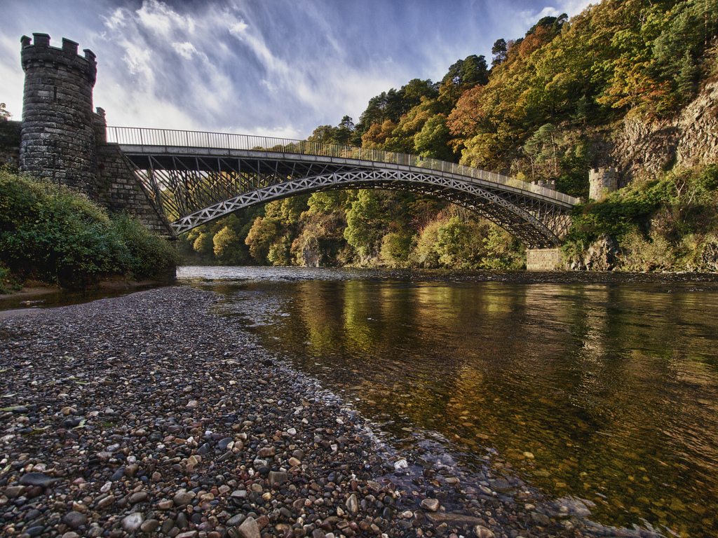
Highlights of the route include Abernethy National Nature Reserve, where bogs, lochans, and pine forest are a haven for native wildlife, the impressive Craigellachie Bridge, built by Thomas Telford, and the Moray Firth Wildlife Centre, one of the best shore-based dolphin watching opportunities in the world.
**Try sampling Aberlour, Balvenie, Craigellachie, Dufftown, Glenfiddich, Knockando, Macallan, Speyside, Tamnavoulin, and you’ll forget that the alphabet has other letters too.

Hebrides Way
- Start: Vatersay
- Finish: Stornoway, Lewis
- Length: approximately 252km (156 miles)
- Average time to complete: 12 days +
- Difficulty: easy to moderate
The newest long-distance trail in Scotland, this route connects 10 spectacularly beautiful islands in the Hebridean archipelago, from Vatersay in the south to Lewis in the north, with two ferry crossings and six interisland causeways, on the wild fringes of the Atlantic Ocean.
The Gaelic culture of the islands is framed by the distinctive landscapes; stunning silver beaches and flower-filled machair, wild moors and mountains, remote crofts and tiny fishing villages, places where both recent history and ancient archaeology lie close to the surface. Look out for wildlife as spectacular as your surroundings, like minke whales, white-tailed sea eagles, and some of the most scarce birds in Britain, like the elusive corncrake.
The most challenging part of the trail follows waymarks on an undefined path across the open moorland of the North Harris Hills and could be tricky in poor visibility, but on the whole, hiking is easygoing and suitable for beginners. It’s worth making some extra time to spend on the islands alongside completing the hike.
Kintyre Way
- Start: Tarbert
- Finish: Machrihanish
- Length: approximately 161km (100 miles)
- Average time to complete: 7 days
- Difficulty: moderate to hard
Zigzagging back and forth across the Kintyre Peninsula, this trail starts in the picturesque fishing village of Tarbert in the north and winds its way to the windswept beach at Machrihanish, which lies closer to Belfast than to Glasgow.
Although Kintyre is part of the mainland, the sea is never far away on this trail, and it has stunning island views of Jura, Arran, Islay, Gigha, and even Rathlin Island. You’re sure to hear the legend of Somerled (Somhairle), the Gaelic Viking King of the Isles, that claimed the land as his own by portaging his ships across the narrow isthmus between the sea lochs at Tarbert.
The trail is well waymarked for most of its length, with easy-going walking, though the last section of the trail beyond Campbeltown has steep ascents and descents, tricky navigation, and boggy conditions underfoot.
Cateran Trail
- Start/Finish: Blairgowrie or Alyth
- Length: approximately 104km (65 miles)
- Average time to complete: 5 days
- Difficulty: moderate
Not as well known as some of the other Great Trails, this is a circular route through the wild upland glens of Angus and Perthshire, taking in Strathardle, Glen Shee and Glen Isla, once lawless bandit country. There is no official start/finish point, but the pretty towns of Blairgowrie and Alyth have good access to the trail, and it is usually walked in a clockwise direction.
The route follows ancient drove roads used to take cattle to the market towns of Alyth and Blairgowrie, and by the Caterans, 16th and 17th-century cattle raiders, who give their name to the trail.
The trail is well waymarked, and the moorland hiking at a moderate level. Several small settlements are on the route, with pubs, cafes, and resupply stops. A link route between Kirkmichael (Strathardle) and Cray (Glen Shee) gives the option of shorter two- or three-day circuits. The route is waymarked but undefined, includes a lot of road walking in places, and parts of the trail can be rough and very muddy.
Rob Roy Way
- Start: Drymen
- Finish: Pitlochry
- Length: 128km (80miles), alternative route via Amulree 155km
- Average time to complete: 6 days (alternative route 7 days)
- Difficulty: moderate to hard
Another route inspired by rogues and reivers, the Rob Roy Way links Drymen, on the edge of Loch Lomond (and the WHW), and Pitlochry. Taking in the rolling hills of the Trossachs, through forests and into Breadalbane, passing lochs and waterfalls, and on into Strathtay.
The route visits the pretty highland towns of Callender, Killin, and Aberfeldy, and Balquidder, the site of Rob Roy’s family home. A Jacobite who fought alongside Bonnie Dundee, he, and the rest of Clan McGregor, were outlawed and compelled to renounce their name and allegiance or be hunted out with hounds and killed.
The route follows tracks, minor roads, cycle trails, and footpaths, with a fair amount of ascent and descent. The alternative route via Amulree is much quieter, and avoids an 8km section on minor roads on the south of Loch Tay. Both options have spectacular views across to the Munros of Ben Lawers and Schiehallion on a fine day.
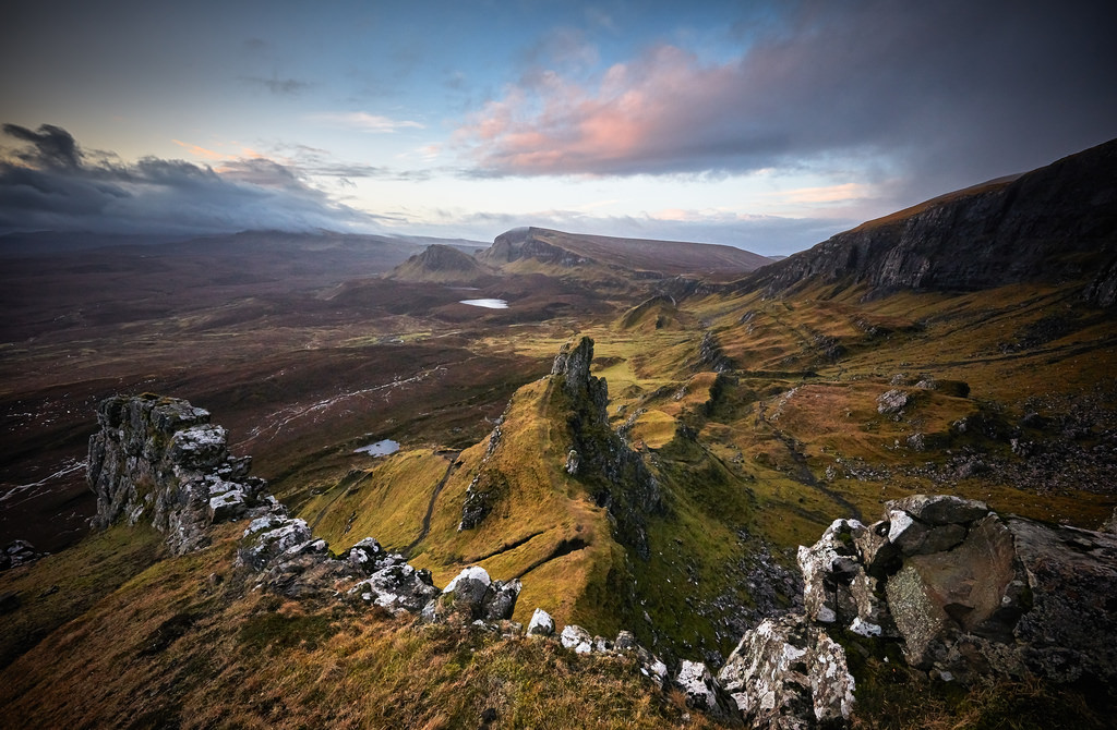
Skye Trail
- Start: Rubha Hunish, near Duntulum
- Finish: Broadford
- Length: approximately 128km (80 miles)
- Average time to complete: 7 days
- Difficulty: very hard
Starting from the most northerly point of the island, Rubha Hunish, the route ascends steeply under the Quiraing to the Trotternish Ridge. The ridge traverse is very long and exposed, but is one of the most outstanding ridge walks anywhere in the world.
After following the cliffs from Storr, the route goes via Portree and Glen Sligachan to Elgol and Torrin, finishing in Broadford. It passes the locations of several clearance villages, tumbledown reminders that these quiet glens were once home to hundreds of people, and around the spectacular Cuillin mountains.
The trail is unofficial, unmarked, and arduous, and many sections lack a distinct path. It requires excellent navigation skills, and involves challenging burn crossings that are not possible when in spate. The route includes a long ridge traverse and clifftop walking not suited to those without a head for heights.
Cape Wrath Trail
- Start: Fort William
- Finish: Cape Wrath
- Length: Between 320 and 370km (200 and 230 miles)
- Average time to complete: Around 20 days
- Difficulty: very hard
The Cape Wrath Trail is an epic route, leading from Fort William, through some of the wildest and most remote parts of Scotland, to the northwesternmost tip of mainland Britain.
Potential highlights of the route include crossing the Rough Bounds of Knoydart, the Falls of Glomachand and Eas a’ Chual Aluinn (the highest waterfalls in the UK), Fisherfield Forest, the caves around Inchnadamph, and the spectacular beaches at Oldshoremore and Sandwood Bay.
With no official route, and several potential options taking you through Knoydart, Torridon, and Assynt, it isn’t waymarked and many sections don’t have a defined path. It is suitable for backpackers with excellent navigation skills, the ability to be self-sufficient, and wild camping experience.
Things to know before attempting a long-distance hike in Scotland
- Weather
The Big Yin*** once said that “there are two seasons in Scotland: June and winter”. But even the notoriously changeable weather can’t spoil the hauntingly beautiful landscapes you’ll walk through. Be sure you’re adequately prepared; check long-range forecasts and monitor the weather during your hike, pack sufficient warm layers and waterproof jacket and trousers, and know your route well enough to identify wet weather alternatives and bail-out points.
***That’s Billy Connolly if you didn’t know. Or Sir William Connolly CBE, if we’re going to be formal. Which he famously isn’t.
- Wild Camping
There will be a range of different options for accommodation on most of the trails listed above, from bunkhouses and bothies to boutique hotels and guesthouses. But for staying as close to the trail as possible and maximising time outdoors, you might choose to wild camp (I usually do).
Wild camping is permitted in Scotland, with the notable exception of the east side of Loch Lomond (on the WHW) during the summer months. You must be familiar with the Scottish Outdoor Access Code and follow leave no trace principles.
- Wildlife
We don’t have some of the large wildlife of our neighbours in northern Scandinavia or central Europe to worry about, and you should try to avoid causing any disturbance to habitats or creatures as you follow the trails or camp.
Scottish midges have a fearsome reputation, and it’s well deserved. May and September are usually the best months for avoiding the wee beasties but still getting the best of the weather. Otherwise pack a repellent, especially for dawn and dusk, and just after rain showers.
- Winter
Winter hiking in Scotland is serious and brings several additional hazards to the routes described above. Some of the trails above will be inaccessible to all but the most experienced backpackers. It is important to be properly prepared, and that can mean taking an ice axe and crampons, and having the skills and experience to use them correctly.
It also means taking additional time to assess your chosen route; researching mountain weather, taking account of reduced daylight hours, the terrain and underfoot conditions, and avalanche forecasts. And remember that sometimes the best decision you make is to postpone the hike for another day.
Have you tried hiking any of these trails? Have you got any tips to share?
Why not pin this to your hiking boards for later?


The compete cuillin ridge is a must, not really a long distance but a lot of upping and downing. Take your time and bivvy on the top overnight for that extra experience
Scotland is pretty high on my travel bucket list. I need to go here. Thanks for the tip about the Scottish midges (or wee beasties). Midges in general are a pain to deal with.